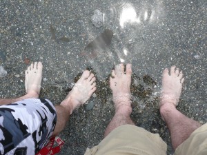
2014 – New York/ Pennsylvania

Day 1 – August 6th, 2014 – departure London, Ontario – 0740hrs

Three day forecast calling for clear skies.

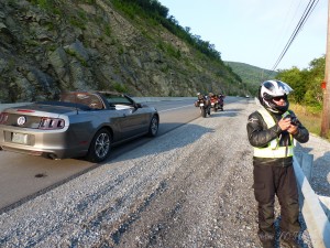
We, and by we I mean JR riding his Kawi Versys which he cleverly rebranded by carefully removing the tank decals and replacing them with “Kwikasfaki” and SB driving his shiny new 2014 Ford Mustang convertible. For a variety of reasons SB traded in his motorcycle this season on the convertible. A better fit for life at this point. Semi-retired he is still up for a tour at the drop of a hat and we have shared a lot of miles together so he has a free pass on the motorcycle tours. Truth be told it was handy having the car around. Useful on more than one occasion. For example a problem with the GoPro battery and SB was able to plug it in and charge it as we scooted along. This meant we did miss out on some nice vid capture.

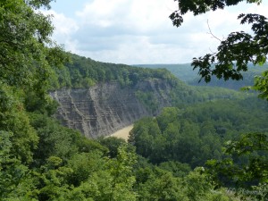
P1010407

As often happens when I get riding along, I get thinking because other than looking at the scenery that is about all there is to do when left to your own devices inside the solitude of a helmet.

I am going to have to come up with a system of dicating my thoughts via a microphone inside my helmet because I had all sorts of humours ideas for content here and as usual I have forgotten 90% of it. I’m not sure talking to myself is necessarily the answer but I’m in their alone so who will know.

The day started with a straight forward run for the border crossing at Fort Erie. I am not a fan of the bloated border crossings we have to endure to escape Southwestern Ontario. I think it would improve tourism both ways if this wasn’t such a chore.

Ontario has some amazing spots to visit on little two and three day excursions so I will preface my next comment with, “I love Tobermory and all areas of Ontario easily reachable in a day or two” but when you consider in the same 4 hours it takes you to get to the Upper Bruce you can be well into NY or very close to the mountains of PA. Just sayin, it’s a nice option. One not exercised often enough in large part due to….well as I said, fun and games at the border.

As luck would have it todays crossing was not bad. Maybe a half hour of shuffling slowly forward on the bike and it was my turn. Of our little group I was the first in line and after all the standard questions the USBP officer asked if the next motorcycle was with me. I said, “yes and the Ford Mustang behind him”.  “A car” she stated, somewhat surprised. “Yes he just traded in his motorcycle and we still sort of like him so we let him come along”, I said. She laughed and sent me on my way. The first time we stopped after the border he told JR and I that she threw us under the bus, said we were hacking on him a bit. They had a nice conversation at the end of which she apparently professed she’d rather tour in his mustang then on the back of a motorcycle……shama lama ding dong ……..and his heart grew three sizes that day. Didn’t hurt his ego either, lol.

JR shared a story from a border crossing he did recently on trip to NY City and then up into Quebec on the return trip. He had selected a small remote crossing that work out well for the route they were taking and he thought his boys would find it cool by comparision to the larger crossings the were used to. When he pulled up he was asked the easily anticipated first question, “citizenship” but the second question took him back a bit, “Why did you pick this crossing”. I guess they figure everyone thinks it will be a push over crossing at the small points. Now his inside voice said “Jeez, why!  You’re not planning to look in the trunk are you? but then he explained why and things went waaaaaay smoother. But wouldn’t part of you like to say it for shits and giggles.

We travelled away from the border toward Aurora on 400 but exited quickly to 20A eastbound toward Letchworth State Park .

We were only about 4 hours into our little adventure when we reached the park entrance. A lone, older gentleman was on duty. There was a row of cars and a second row for buses only. There were three busses in line and he was running back and forth attempting to deal with everyone in the order they arrived at the gate.

I pulled ahead as the car before me cleared. He said he’d be right back and rushed off to see to the buses.

I had the money in my hand when he returned (key point in just a moment), I paid, asked him for a map and moved on. I thought he was pleasant and helpful.  We stopped at the first parking area to look at the dam.

SB relayed to us that when he pulled ahead and handed the guy his cash and ……for the sake of the story lets just call him Crusty the Park Clown said, in a grumpy I don’t care for motorcycles tone, “You’d think while I was looking after the busses they could at  least have their money ready.” SB went onto suggest, “Well they have gloves on and such I guess it takes longer”. “Yeah I guess so. You need a map?”, snapped Crusty. “No, I’m with them”, said SB. There was an awkward pause…….. followed by Crusty quietly mumbling “oh, sorry”. SB pulled away. SB said he’d wished he had a picture of the expression on his face during the awkward moment as Crusty attempted to extricate his foot from his mouth. Important life lesson, don’t say anything behind someone’s back that you wouldn’t say to their face. Or if you have a big mouth, small feet would be an asset.

P1010409 P1010418 P1010432

We spent almost two hours making our way through the park. Stopping on several occasions to look around and take a few pictures.

Continuing south out of the park on 19A was a beautiful route following along the banks of the Genesee River. Then veering southwest, just shy of Wellsville, on 417 and following this to 44. We took 44 south and crossed into PA.

The sky was a little unwelcome looking depending on which direction you were pointing. That’s PA for you. mountains and valleys play with the fronts that come off Lake Erie. With roads running like spiderwebs off in different directions its difficult to predict whether you need you rain gear or not. At one point JR and I were convinced that we were moments away from a torrential down pour so we reluctantly suited up. There was lots of evidence the precipitation was close by. On more than one occasion we rounded a bend in the road to see the moisture evaporating from the hot road surface like a low mist.

JR predicted at the beginning of the day that Coudersport PA would likely be a spot we could encounter rain. It sure did look like it but again nothing. The sky cleared and somewhere south of Oleona on 44 I removed my gear. JR declined citing the last time we had exercised a similar option he was out a pair of perfectly good leather riding gloves.

We had all brought camping gear but had some discussion about this and it was unanimous that we would search for a hotel or motel at the end of the day. Along this particular route camping was sparse and where we did see a campground it was mostly trailers. Must be a reason for that.

South on 44 to Haneyville, then carrying on down 664 to Lock Haven. where we stopped for the day.

Best Western in Lock Haven was very nice.  Restaurants on the other hand were very thin on options. I won’t mention the name of the establishment we landed in but out of the 20 brands of beer listed on their menu they had 4 lite beers and were out of the rest. I order a  flat iron steak…..guess what….yup, out of that too. What they did have was OK.

650 kilometres by my rough calculations.

Day 2 – August 7th, 2014 – 0730hrs

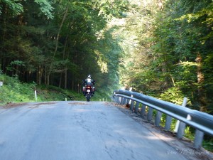
Nice Continental breakie in the lobby and we are away to the races. cutting west- northwest out of Lock Haven on 120.  Of note Highway 120 follows the banks of the Susquehanna River and for those old enough to remember Abbot and Costello I need say no more. For everyone else you need to check You Tube for the Susquehanna Hat Company skit. I digress, not far along 120 we paused for an early morning photo op along the side of the highway.

P1010445

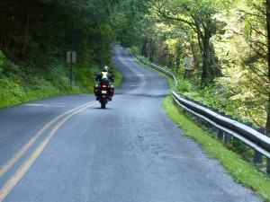
We followed 120 to 1004 otherwise known as Hyner Run. A road that runs northeast through Hyner State Park. There will be video of this area to follow. We found a spot past the state park where we could pull over and we played……..I mean rode back and forth along a particular stretch for about 45 minutes.

Continuing on to where Hyner run connects with 44 we road north along a stretch we we had come south on yesterday. The plan was to take road 4005 southwest back toward Renovo but we discovered that dispite the existence of this road on my GPS and on the official map of PA it, in fact, did not exist. Perhaps the road map was from an alternative reality.

P1010460 P1010462

We elected to continue doubling back on 44, a win/win for sure, to 144 at Oleona where we would take 144 south.

JR fuelled up here at the junctions of 44 and 144.

P1010465

We went south on 144 and at the junction with 4001 I made a last minute decision to follow 4001 instead of making the turn to  Tamarack. This was partly based on the sign I saw for the dam that we would find ahead. A good choice I think, beautiful stretch of road.

P1010477 P1010486


View looking back to the north from the dam.

P1010500

Connecting back with 120 near Westport we continued westish. It turns out that by days end these little modifications to the route were likely for the best for a few reasons. There was no scenery sacrificed in the making of these decisions.

P1010505

P1010509

Near Stirling Run JR pauses to see if whatever stung him in the face required CPR……alas it was too late. After a thorough grid search of the helmets interior to ensure the little huge bugger was gone we we’re once again moving west on 120.

After passing what was quite possible the most convoluted attempt of traffic management through intersection design by the Marx  Brothers in St Marys we arrived in Ridgway.

Here I had decided on a series of roads I couldn’t find on my GPS mapping software until I zoomed in to 200 meters.

We took Laurel Hill Rd west out of Ridgway. The first few kilometres are fantastic. The whole route was great but this first stretch, wow. This road turns into Spring Creek Rd and then Halton Rd before becoming 3002 and finally Loleta Rd into Marienville.

Marienville was to be the stop for day two but with the adjustments earlier in the day it was only about 1430 hrs.

I took a look on the map and we set our sights on a roundabout route to Kane PA just up  66 from Marienville. We headed north on 66 but went off on Blue Jay Rd and followed it to the shot below.

P1010525

666N to 948N and east on 6 at Sheffield we eventually arrived in Kane.  It was still only about 1530 hrs but we elected to call it a day and this still put us in good position for the morning. We hit a party store with the thought of grabbing a couple beers each to kick back with only to discover in PA you can only buy a minimum of 24 in a party store. If you want a 6 pack you have to go to a bar or restaurant to buy it and of course it is more expensive. I will reserve comment on this peculiar legislation but I will say it seems to promote the potential for excessive drinking.

After a ride around Kane looking for accommodation and discovering that several listed on my GPS were no longer in business we finally arrived at the Kane Motel right in the heart of the thriving core area. It turned out that this search around Kane carried on just long enough for a friend of the winged terror that attempted to infiltrate JR’s helmet earlier to seek me out.  He must have been very determined to avenge his cohort premature demise because he had to thread himself over my windshield, under my partially close visor and over the left arm of my glasses before impacting with a smack and stings to my left temple. I’m not sure what it was but it left one hell of a lump and multiple marks that was tender to the touch for a couple days.

After we settle in and had an ale or two we had a little walk around the downtown area hunting for dinner. The main street had a couple of restaurants, one of which was closed for a week while staff took a holiday.  We wandered into the only other one worth mentioning. The historical looking facade drew us in like Hansel and Gretel to a gingerbread house. We entered to find ourselves in an alcove which led to a dimly lit hallway that stretched out in front of us and led away from the street and into the bowels of the establishment. We arrived at a closed door at the end of this hallway and paused to look through the heavily tinted glass. What was revealed inside was ……well I’ll be kind and say it was underwhelming.  We glanced at one another and had a short discussion (1.5 seconds) and it was unanimous…..  nope, no way, ain’t happenin. We wheeled to leave and got about half way down the hallway when from behind I heard a voice, clearly a woman, but I can only describe the voice as having a quality sort of  deep and similar to dragging a canvas bag full of gravel over asphalt. JR actually whimpered I think, at least in my mind he did or maybe it was me.  “Where you going, you coming back”, she said in a sort of desperate you’re my only customers tone. We promised we’d be back and continued out to the sidewalk. I suspect she is still waiting.

We finally arrived at spot, originally recommended by the motel owner, called the Texas Hot Lunch and it turned out to be a pretty good spot. Afterwards we retired to some chairs in front of our room at the Kane Motel we enjoyed several ale and a cigar. We struck up a conversation with a chap in the next room, a retired firefighter named Mike who was travelling around doing research for a book he was writing on forest fire fight. A very pleasant evening of conversation.

378 kilometres

Day 3 – August 8th, 2014

We departed early, just before 7 with the thought of getting a couple hours under our belts before stopping for breakfast.

It was very foggy and 9 Celsius, we’ve camped in much cooler weather but we were pleased with our motel decision. Literally a rough start to the day with the first 8 miles of  321 out of Kane being under construction and unlike its namesake SB’s Mustang did not like gravel at all. I guess more accurately SB didn’t like putting those two things together. The highway did turn back to asphalt and from what I could make out through the still heavy fog this road would certainly be a keeper. I was also able to make out through the fog several deer including the two that ran across the road in front of me. Not close enough to be any real concern but its never the one you see that ruins your day. I think these two made 4 that had run across the road in front us since Wednesday.

PA 321 passes into NY in the middle of a lush forest and becomes Highway 280. From 280 to Interstate 86 but only for a short distance before heading north on into Salamanca for fuel and breakfast across from the gas station in a strip plaza. This was like stepping into a smoke filled greasy spoon time machine but it was actually pretty good and it hit the spot.

Then we were off, north on 353 to 62.  In my head I started writing the lyrics to a possible top 40 hit, Salmonella in Salamanca. Salmonella in Salamanca, I should’ve seen it coming this belly ache-a. Sorry, not everything that comes to mind inside the helmet is gold.

I have done the route north on 219 back to the border and I would take 353/62 every time. The prettiest parts of 219 are south of Interstate 86. When 219 meets 86, 353 is only a couple kilometres to the west and the ride back up into Buffalo from this point on is much more relaxed on 353. You go slower through a few small towns but by the time you hit Buffalo I found the mass of interstates converging here far less stressful.

A bit of a wait crossing the border but not too bad. Back on Canadian soil and an easy run back to London.

All in all great trip. Lots of laughs as usual. Great route.

448 kilometres.

TOTAL – 1426 kilometres 

Download file: 2014 NY Penn Revised2.gpx


Posted in Tours | Tagged , , | 3 Comments

2009 – Three Generations PtVI

Day 18, July 7th and another early start, 6:20 and we were on the road with clearing skies and a temperature of 36 degrees Fahrenheit.

P1070706

Alpine Motel

We could not possibly have begun to comprehend the beauty we would see that day. It would be a tossup between this day and day 8 and 9 for the most visually stimulating day.

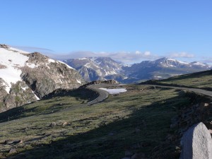
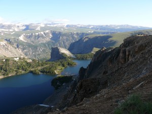
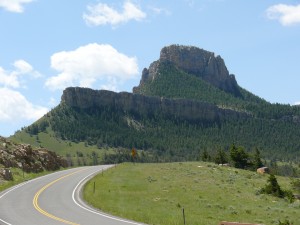
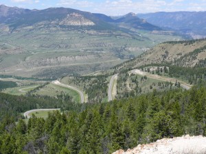
We travelled along highway 212 ascending Bear Tooth Pass to an elevation of 10,974 feet and passing into Montana again. The scenery along this section defies description with the sun shining down on the still snow capped peaks, the fresh mountain air and the road snaking its way back and forth up over the top and descending down to the valley floor on the Montana side. There was evidence of some substantial landslides along the side of the road reminding us that this area could be as dangerous as it is beautiful.

P1070713P P1070714xx P1070718

Where we needed to get to that day the only practical way to get there was to go back over the top of Bear Tooth Pass. So after a nice breakfast at a little spot in Red Lodge off we set. I had mixed emotions about traveling the same route we had just done…..yeah right. I could go back and forth over the pass all day long and I’m pretty certain I wouldn’t get bored.

So Bear Tooth Pass twice in one day, well you’d think that would be enough and you’d be wrong. Once we got back over the pass we took highway 296 toward Cody, Wyoming. This route is also known as the Chief Joseph Scenic Highway and was absolutely incredible. I think it was right around this point that dad told me for the second time that I had outdone myself with the route.

P1070747 P1070754 P1070765

We were not done yet. In Cody as highway 14 continues east there are a north route and a south route. We elected to take the north route which passes through Big Horn Canyon National Recreation Area. I have a friend who was on a trip that took him through this area a couple of weeks ahead of us and later when we compared notes it was clear, north route, south route it would be hard to go wrong. The weather was absolutely perfect for us but his experience was a bit different. He was at elevation under bleak skies when he rounded a curve right into a snow storm. It didn’t last long but provided for a white knuckle moment for him.

We encountered more buffalo here, an amazing animal. They were right up on the roadway and don’t seem to be bothered at all by all the cars.

The route down off the mountain was a series of switchbacks that were an absolute blast. We connected with Interstate 90 and a short distance later we stopped in Buffalo, Wyoming for the night at the Blue Gables Motel.

Day 19, July 8th another early start with the only highway to take being Interstate 90. We followed this to near Moorcroft where we turned north on hwy 14 to Devil’s Tower, Wyoming.

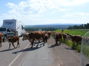
Not long on hwy 14 the oncoming traffic began flashing their headlights at everyone and then I could see in the distance traffic was slowing. Immediately your mind jumps to what, an accident and of course the thought of “I hope no one is seriously injured.” As we crested the next hill we were faced with a slightly different situation, cowboys and cattle. Yep partner a genuine cattle drive right down the middle of the highway. Hum now there’s something you don’t see every day or I guess around there maybe it is.

P1070768

Now where was, oh yeah the tower, I had wanted to see the tower since I was introduced to it in the 1977 classic, Close Encounters of the Third Kind, starring Richard Dreyfuss, where it was portrayed as this mysterious location that celestial beings would use as a docking station for their spacecraft. We spent a bit of time looking around and got a number of good pictures before pressing on. Going for a short hike here might be the only thing I would change if I were to go back. At the time it didn’t seem necessary. Of course this is always a bit difficult when travelling by bike as there are limited means of securing all the gear you are carrying.

P1070777 P1070793

We continued around the hwy 14 loop to Sundance a town named after the sun dance ceremony practiced by several North American Indian Nations but probably better known because of the man that earned his nickname there. In 1888 after his release from a Sundance jail Harry Longabaugh became better known as the Sundance Kid. When I think about the distance we were from Telluride, Colorado and reflect on the activities of Butch Cassidy his eventual partner, I am struck by far apart these two locations were and at a time when their primary source of transportation would have been horseback, it is truly amazing that these two men ever crossed paths let alone that they would go on to be the stuff legends are made of.

From Sundance we took hwy 585 south where it connected to hwy 85. We took hwy 85 north all the way to Deadwood. It was a slightly different route into the area then I had planned on but it turned out to be great.

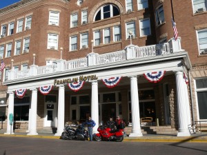
It was shortly after noon but we decided to get room and spend the rest of the day roaming around Deadwood. We managed to find a room at the historic Franklin Hotel named after a local entrepreneur and businessman Harris Franklin. The businessmen of Deadwood had been trying to build a hotel for years but it wasn’t until Franklin came forward and personal offered to match dollar for dollar any money raised that they finally had the funds to move forward and the Franklin opened in 1903. The hotel has seen tough times over the years and in 2005 was purchased by the Silverado Gaming Establishment and is currently undergoing a 7 million dollar makeover.  A lot of famous people have laid their heads to rest inside those walls over the years, including Buffalo Bill Cody, Theodore Roosevelt, William Taft and John Wayne.

Franklin Motel

Franklin Motel

We strolled the main street, checked out the shops, watched a couple of gunfight reenactments and had a beer in the bar were Wild Bill Hickok was shot dead by a sore loser after a poker game in 1876. We jumped on a tour bus and took a ride through Deadwood to Boot Hill and the gravesites of Wild Bill and Calamity Jane. Point of interest, despite the stories Hollywood has woven around the relationship between these two people the truth is that they hardly knew each other. All in all our day in Deadwood was a very interesting one.

P1070821 P1070842

P1070826

Day 20, July 9th now if you have a map you would need it to follow along with today’s travels. We went south of 385 to Custer where we turned east on 16. We took a short side trip off on the Wildlife Loop Rd. and then continued east on 16 to Iron Mountain Road. This is a must see when in the area and the best way to experience it is to come north so that you get to see Mt. Rushmore as you pass through a series of tunnels cut in the rock along this road.

P1070874

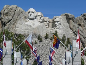
We stopped at Mt. Rushmore and took some pictures. It might have been neat to go for a hike up to the base of the mountain but really other than getting sweaty and being able to get a much closer look at the presidential granite nostril hair there wasn’t any need.

P1070882

We carried on north on Iron Mountain Road/ hwy 16 then west on 244 and south on 385 for the second time today but only briefly as we turned east on 87 perhaps better known as Needles Scenic Drive. This is a very interesting drive and another must see when in the area. We stopped and I did a little rock climbing in search of the perfect spot to take some pictures.

P1070902

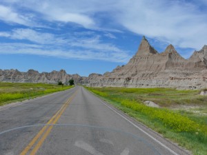
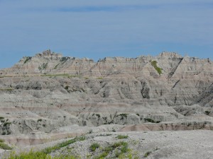
Back on the road this drive connects back to hwy 16 again and we headed east to where 16 becomes 36 and eventually meets with 79 north to Rapid City. In Rapid City we took hwy 44 which runs east through the Badlands. Inside the Badlands we took hwy 240 north through the heart of the Badlands a truly remarkable drive.

P1070938aa P1070954 P1070955zz

Highway 240 eventually leads to Wall and the famous Wall Drug store which of course we took a walk through. It you need it and even if you don’t you can probably find it inside the walls of the Wall Drug store. There were the normal snacks and souvenirs but then there was all the leather products like a complete 6 gun rig or the stars and stripes cowboy boots for the geographically challenged cowboy just in case he forgets where he is.

As we left Wall we took Interstate 90 east and stopped for the night in Murdo. After dinner at the Rusty Spur which was next to the motel we had a discussion about the route from this point forward. We had intended to head south into Nebraska and the east but instead we opted to continue east across South Dakota into Minnesota. The next discussion centered on the distance to home. We decided that we had seen everything we had set out to at this point and that we could be home in a couple of days barring the unforeseen.

Day 20, July 10th we continued east on Interstate 90 leaving South Dakota behind us and passing into and through Minnesota ending the day in Wisconsin about 1100 kilometers further down the road from where we started the day. Travelling the interstate is not the way to take in the scenery but it does tend to get you from A to B reasonably quick and it made for a pretty straight forward day. It was dad’s birthday so I gave him the cards I have been carrying for about 11,000 kilometers since we left home.

Day 21, July 11th the skies to the east did not look inviting in the least so we got our raingear on and set out. I cannot possibly overstate how much I dislike taking the interstate through Chicago. It is like anything I suppose you could get used to it and it would be a different experience if you travelled it a lot but if it were not for the GPS it would have been a very unpleasant experience.

With Chicago behind us I for one was more relaxed. We still had a long drive ahead but it was a clear sign that that evening we would be sleeping in our own beds.

All along we had been telling family that we are on track with our original projections to arrive home around July 15th so everyone was quite surprised when we pulled in the driveway a little after 5 that afternoon, 852 kilometers for the final leg of the journey.

We saw a lot of extraordinary scenery on this trip; we had some good conversations, a lot of laughs, took a lot of pictures and made some good memories. As the picture fades to black on this trip its true what they say, just like in life, it’s all about the journey.

“Remember what Bilbo used to say: It’s a dangerous business, Frodo, going out your door. You step onto the road, and if you don’t keep your feet, there’s no knowing where you might be swept off to.”

J.R.R. Tolkien (Lord of the Rings)

I encourage everyone to step out and get swept away.


If you stuck with the story and made it this far then here is a little treat.

ROUTE MAP DAYS 18 TO 21

Download file: 3Gen Day 18-21.gpx
Posted in Uncategorized | Leave a comment

2009 – Three Generations PtV

Day 14, July 3rd I took dad to the shop for 10 am and returned to the hotel to shuttle all his gear over in hopes we could shave some time off and get away quicker once his bike was ready. Nathan and I got packed and headed out to meet him. Guess what, 1100 became 1:30 in the afternoon, I guess lunch and stuff got in the way. As I alluded to earlier, not typical of the service I have experienced before. As we waited we got talking to a couple of other guys waiting for their bikes and as it turned out they were from Victoria B.C. but one of them had  grown up in London not far from where I did and he attended a rival high school, small world.

We travelled out of Medford on hwy 62 north and then east to the entrance to Crater Lake. It was a hot humid drive with the temperature rising to about 100. As we entered the Crater Lake area it began to cloud over and as we ascended up to the lake ring road the temperature dropped to 60. We got a few nice photos but our time here was short lived as a storm rolled in and we decided to press on so as not to get caught. Issue two was that there was one or two maybe, oh, a trillion mosquitoes that were out to drain anything they could sink their pointy little proboscis into.

Crater Lake, Oregon

Crater Lake, Oregon

Rustler's Inn Prineville, Oregon. Great spot.

We travelled around the west portion of the ring road and down the north side to hwy 138 then west to hwy 97 north.

Just south of Bend we took a bypass that came out on hwy 126 near Powell Butte. Then east (whoa east that must mean something) to Prineville, Oregon where we found a great western style motel called the Rustlers Inn. We kicked back after dinner with a cigar and beer; I think I could get used to doing this for a living.

Rustler's Inn Prineville, Oregon. Great spot.

Rustler’s Inn Prineville, Oregon. Great spot.

Day 15, July 4th following hwy 26 east out of Prineville leads through the Ochoco National Forest and past the John Day Fossil Beds National Monument. The discovery and study of fossils in this area began in 1881 when fossilized remains of a rhinoceros where discovered during an army expedition. John Day, after which a river and nearby town are also named, was a member of the Astor Expedition that passed through this area in 1810-1812.

Part of John Day Fossil Beds National Monument

Part of John Day Fossil Beds National Monument

A bit N/E of Prairie City we took hwy 7 toward Baker City where we continued N/E on hwy 86 stopping in Richland for lunch. We got talking to the waitress and found out she was Canadian, born in Alberta in the same town as dad’s cousin Barbara Nelson, once again, small world.

P1070497aa

The next leg of our little journey would take us on a 44 mile round trip north along the east bank of the Snake River to the Hell’s Canyon Dam. This is right on the Oregon and Idaho border and is a must see when in the area. It was easy to find because I had it in the GPS. Otherwise the map I had lacked in detail and it might have been a bit trickier to find the road. I got a number of good pictures and used the GoPro to video the entire trip out.

Hell's Canyon Dam

Hell’s Canyon Dam

Snake River Canyon

Snake River Canyon

Now south on hwy 71 a very exciting, twisty stretch of road that runs south along the Snake River for a bit before breaking away S/E just south of the Brownlee Dam. In Cambridge we took hwy 95 toward Council. The weather was getting a bit questionable looking and we did get rain on a bit north of Council. Thankfully it didn’t last long. With it being July 4th the area was very busy. We took hwy 55 south near New Meadows to McCall which is a resort community on Payette Lake much like a number of small towns you could find up around Huntsville or Bracebridge here in Ontario.

Everything in McCall was booked but we managed to find a nice B&B (Meadowood Lodge) for the night north of McCall so we had to double back a short distance. We lucked out again I would highly recommend this lodge if in the area. They could accommodate a fairly large group if arrangements were made ahead of time.

Day 16, July 5th began at 6:30 with washing the bikes before anyone was up. We had a nice breakfast and bid our hosts adieu and we were off south of 55 toward Boise, a beautiful drive down out of the mountains.

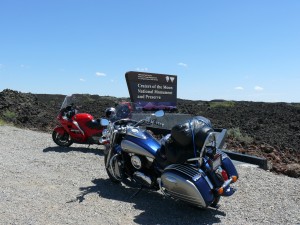
It had been recommended to me before the trip that once in Boise we take hwy 21 north east back up into the mountains then hwy 75 down through Sawtooth National Recreation Area but we decided not to and opted on taking Interstate 84 and cut off on hwy 20 and connecting with hwy 26 in Carey. We turned and headed toward Arco stopping several times to take pictures as we entered the lava beds of Craters of the Moon National Monument. We actually went into the park and did a loop the park road through the lava fields. This was ten different kinds of cool. The soil, if you could call it that, was course granulates of lava rock. Nathan and I climbed a very high mound of this lava granulate in the middle of the park and the view was amazing.

P1070521 P1070553

P1070556h P1070558

In Arco we headed east on 20/26 to Idaho Falls where we spend the night at the Red Lion Hotel next to the Snake River. We had a great dinner at the Brownstone Restaurant just down the street from the hotel. We ate out of the patio with a view of the park and Snake River across the street.

A nasty looking storm rolled in overnight again seemed to miss us. We have been ridiculously fortunate when it comes to avoid bad weather.

Idaho Falls. Days End

Idaho Falls. Days End

Day 17, July 6th I looked out and saw a group of people unloading bicycles from a cube van. Dad was already down packing his bike and I could see him talking to them. Over breakfast he explained how there were 65 cyclists in all and some had already set out this morning. They had been planning this trip for about 5 years and were travelling from somewhere in Oregon to New Hampshire. Their journey was actually going to take them through London around July 31st, there’s that, it’s a small world thing again.

We headed out of Idaho Falls on hwy 26 and deviated from the set route by taking hwy 31 in Swan Valley. We had passed a lot of the cyclists as we had made our way to that point. It was a very windy morning and for the cyclists it would have been ugly, sort of a head/ cross wind. I’ve been in their shoes and it ain’t fun but the scenery would make it a bit easier to handle.

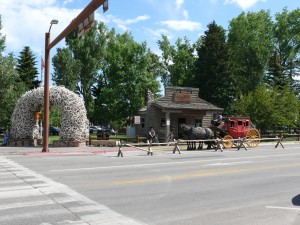
Highway 31 brought us into a small town called Victor and from there we took 33/22 through the Bridger-Teton National Forest to Jackson, Wyoming. Oh man the scenery was amazing with the Tetons off to the north as you descend into Jackson. Jackson itself….a bit commercial but interesting and we parked and did the touristy thing because …well we were tourists so we checked out some shops.

P1070601

Entering Jackson Hole, Wyoming. Grand Tetons in the distance

Entering Jackson Hole, Wyoming. Grand Tetons in the distance

P1070619

Leaving Jackson we took hwy 191 and then 287 into the Grand Teton National Park which eventually led us into Yellowstone.

P1070629 P1070657f

There was a fare bit of construction in parts of the park and the going was a bit slow at times but that was great for taking in the scenery and there was no shortage of that.

P1070658 P1070663

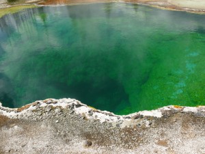
We stopped and hiked around for a bit at the West Thumb geyser basin. Looking off across Lake Yellowstone there appeared to be some miserable weather off to the east toward Cody, Wyoming. I got some really interesting pictures of the thermal pools which tip the thermometer in excess to 170 degrees Fahrenheit, apparently not an appropriate substitute for a hot tub.

P1070679

I talked to some other bikers here who had entered into the park from Cody and as I had previously predicted they had encountered some awful conditions complete with high winds, hail, rain and lightning. He looked a bit irritated when I told him we had missed it all.

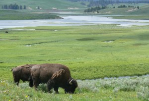
Continuing from there we made our way toward Fishing Bridge where we turned north off 287. I believe that this was hwy 212 and it was on this stretch of highway running along the Lamar River that we got our first up close and personal look at Buffalo, lots and lots of them. With that came some wonder photo ops again.

P1070686m

We eventually made our way out of the park to our resting place for the evening in Cooke City, Montana. We had considered going over the top of Bear Tooth Pass and staying in Red Lodge, Montana but decided against it as it was a bit late in the day and the weather ahead looked sketchy.

ROUTE MAP DAYS 14 TO 17 


Download file: 3Gen Day 14-17.gpx

Posted in Tours | Tagged , | Leave a comment

1984 – First Long Solo Tour

I got my motorcycle and car licenses almost simultaneously when I turned 16. My dad had been riding motorcycles and touring for years. To date he has certainly travelled north of a million kilometers by bike. At 16  it was pretty cool for me to then start taking short trips and eventually as you will see elsewhere in this blog some much longer adventures together. As I started developing this blog I had a notion that at some point I would pause and reflect on what was my first long solo tour from the summer of 1984.

Pause …..reflect….strain to remember…..reflect…..where did I store that memory….oh yes here we go, file accessed.

I had a job at the time and was going to school to tidy up a few things so I might be in a better position to focus on a career path. Translation didn’t care particularly for school then realized very quickly how essential it was going to be to any kind of meaningful future, drat.

I had an idea for a trip to the west coast and once I got started in a career I knew that for a few years anyway this would become infinitely more complicated. I would like to take full credit for this idea but the inspiration came from a similar trip my father had taken by land yacht around 1958 with a friend of his. Though if you talk to him about it, it was a way bigger adventure.

I believe Ecclesiastes 3 speaks to there being “A Time for Everything” and goes on to note 14 different items. I am confident had motorcycles been invented they would have made the list at 15.  I think The Byrds put this biblical verse to music with “Turn, Turn, Turn” and the exclusion of motorcycling was simply an oversight on their part or perhaps lyrically it is difficult to rythme anything with motorcycle. Bicycle……icicle……popsicle……ya complicated.

I digress. At the same time the stars aligned in the spring of 84′ to repair some damage I had done to my knee. By early June, with considerable effort, physio was ahead of schedule so with the blessing of the therapist I was good to go so I surmised if this was going to happen this was indeed the time for this thing.

The following are from notes I made in a journal each day. Keep in mind I’m trying to capture the thoughts I had as a 21 year old.

9751km but this does not count a couple little side trips. One being a day in San Francisco from my aunts home in Woodland, California. I tried to reconstruct this with the aid of modern GPS mapping software but my map program didn’t like it when I tried to navigate around San Fran……as I recall I didn’t much care for it either at the time so I completely understand.

Download file: 1984.gpx

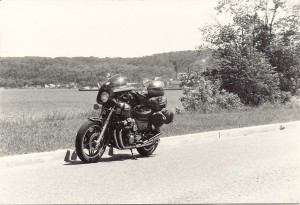
My trusted steed for this adventure. Honda CB 900 Custom

My trusted steed for this adventure. Honda CB 900 Custom

June 14th, 1984 – Day 1 – Armed with my CAA trip planner I departed London, Ontario at 5 am heading for the border crossing at Sarnia. I crossed over into the U.S. at 6 am, pre passport days, and apparently pre global warming because I’ve noted that the temperature by the time I reached Bay City, Michigan was still only 56 degrees.

Passing over the bridge just north of Mackinaw the skies began to clear and the temperature instantly jumped. I must have been quite chilled at this point because I was quite excited to see the sun and clearing overhead because I noted it was like passing into Paradise Lost. Taking Hwy 2 west at this point I recall how pretty northern Michigan was. About 50 miles east of Ironwood it became overcast once again but the temperature remained warmer.

I passed by Duluth, Minnesota at 6:45 PM and started putting my mind to find a place to camp for the night. A task easier said than done. This is where I discovered one of the shortcomings of the trip planner, a bit thin on details for accommodation and camping. The only camping indicated in the material I had was in Grand Rapids, Minnesota another 70 some miles. I stopped and asked a few people but no one could offer any suggestions. Around 8:45 a short distance west of Warba, Minnesota I found a campground on the north side of the highway. I set up the tent in record time and threw my gear inside, This world land speed record of tent set ups was due to the ridiculous volume of a unique species of Minnesota pterodactyl mosquitos which I was convinced were attempting to carry my motorcycle off across the lake. (a Google search today would suggest this could have been either Rice Lake or Sand Lake). I was forced to join my gear in the protection of tent. I’d been on the road for almost 16 hours. I had travelled 1351 kilometers and was primed to sleep. I have noted that my fuel costs for the day were $22…..bahahahahaha!

Day 2 – June 15th, 1984 – Warba, Minnesota. I woke up, shaved and cleaned up, packed the bike, then paused to look at the time. It was scarcely 6 am and I was on my way. The scenery was much the same as the day before and was still overcast and cool. I stopped for breakfast in Grand Forks and put on my rain gear. It didn’t rain but the entire area was shrouded in a heavy damp mist. A gas attendant I spoke with indicated that it had been like this for nearly 2 weeks. The road visibility was OK but there seemed to be less visibility to my left and right so I have no idea what scenery I might be missing.

By the time I reached Rugby, North Dakota it occurred to me that I has seen about 2 1/2 hours of sun since I left. I was about to changed the focus of the trip to “In quest of the sun” when I reached  Minot, North Dakota only to discover that they had been hiding it there all along.

Fueled up in Minot and headed north. Apparently I was following another motorcyclist and we both managed to get pulled over and dinged for 68 in a 55.

I head north for the border on hwy 52, at a modified rate of speed. This stretch of 52 from Minot to border I noted was beautiful. No need to describe as I have picture. (or I did, damn. Guess I should have described it. Guess I’ll just have to go back one day).

I stopped in Estevan, Saskatchewan and got a TD (when it was just TD) money order for the ticket and promptly went to the post office and mailed it off.

I headed northeast on 39 stopping again in Weyburn for film (ah yes pre digital) the absence of film cost me to miss a really unique sight. Unique to an Ontario boy in Saskatchewan for the first time anyway. I don’t need film to recall this because to me it was so unusual I remember it still today. As I travelled between Estevan and Weyburn the sky above was for the most part sunny and clear and yet there was a light rain falling on me.  Had I been more to the east, roughly in the direction of Brandon, Manitoba this might have made more sense as the sky was eerie and foreboding dark blue grey. If you are not from a part of  the U.S. or Canada that is flat then the terrain here has to be seen to be believed.  It is so absent of contour that you can see for miles (we’ve all heard the watch you dog run away for days reference). This lent to having a front row seat to the awesomeness of what must have been two storm fronts colliding. The clouds to my left where very dark with a distinctive flat bottom side. The clouds to my right were less distinctive and a slightly different shade of grey. As they came together the flat bottoms of the clouds to the left began to curve toward the ground as though being forced under the other front. This same area was providing a violent and incredible display of lightning strikes.

I stopped in Moosejaw for a bite and struck up a conversation with a couple from Regina. I explain what I had seen and they informed my that it really wasn’t that unusual. Well it may be common in these parts but for me it was spec-frickin-tacular. I hope I never take such incredible sights for granted.

It was about 8:30 in the evening when I set up camp just beyond the west edge of Moosejaw in a campground just off the Trans Canada. Another long day of riding at a bit over 14 hours since I started out this morning. 1087 kilometres to be precise.
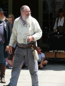
A pleasant evening I set up camp and got cleaned up before sitting at a picnic table and writing down the days concluding thoughts. I watched as the sun dipped below the horizon in the west and the light slowly, I mean really slowly diminished. I looked at my watch to discover it was nearly 11. Another first for me, how late dusk was. Definitely time to turn it as I imagine the converse is true very early in the morning and the tend does little to shade the bright sun.

scan0001a

Somewhere in kisiskâciwanisîpiy, meaning swift flowing river which in 1905 became…..

Day 3 – June 16th, 1984 –Up and away just before 7 under overcast skies. I crossed a time zone somewhere and gain an hour which would be eaten away a short time later when I stopped for some much needed gas only to find the station was not yet opened, curses. Breakfast in Swift Current and on went the rain gear. Thankfully I was able to shed it just prior to reaching Walsh, Alberta. I recall the rest of the afternoon was a mostly clear, pleasant and uneventful ride until somewhere around Strathmore, Alberta, about 50 kilometres from Calgary. If you have traveled west then you know what I started to see on the horizon. It’s hard to put into words how I felt. Excited for sure. By the time I passed through Calgary and could get a full unobstructed view of them it was magnificent. I could send a great deal of time trying to explain what the mountains looked like, the feelings they stir inside you through their sheer size and beauty, feelings that have a tendency to put perspective on our place on this planet. I suspect thats why I have found, in general, that the folks I met living in the shadow of the Rockies have a different perspective on what is important. Nature is to be protected.

I have noted that I took a lot of pictures. Regrettably at this point I have been able to uncover only a handful. Good lesson in that though. Pictures can be important and its wonderful to view them later on and reminisce but there is no substitute for taking the time to be in the moment and fully absorb your surroundings. All you need is a powerful memory etched where it can be retrieved by your minds eye.
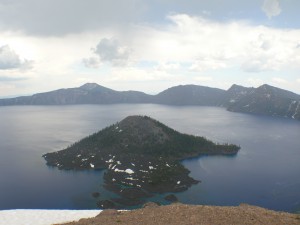
I stopped in Banff briefly and described it as a very cute place. I did not stopped in Lake Louise as it was pouring rain at the time. I took a number of photos as a I passed through the Rockies, Rogers Pass (wowzers) and other glaciers that could be seen from the Trans Canada. Keeping in mind photography came at a cost with the use of film. Realizing no picture would ever capture the beauty I chose the shots carefully.

I noted that I passed through some pretty towns through the Rockies such as Sicamous, Salmon Arms and lest I forget the unbelievable beauty of the The Valley Gap area.

Around 9:30 in the evening it was drizzling and had become quite windy. Another long day of 1253 kilometers had led me to the Monte Vista Motel in Kamloops and my camping for the night.

Day 4 – June 17th, 1984 – On the road around 7 am and although this leg of the journey was still quite pretty it was difficult to really inspired when one compared it to the scenery from the previous day.  Crossing the Port Mann bridge I got a bit turned around and had trouble finding my uncle and aunts. Eventually successful I arrived at 1:45 PM after covering just 425 km. Compared to the past three days this was a brief ride.

Vancouver is quite an incredible place. I would have said at that point in my life if I could have lived anywhere else in Canada then somewhere around Vancouver would have been the place. Although it’s a bit of mystery to me how anyone can afford to live there.

I stayed in Vancouver until my departure July 25th. Humph, 8 days, reflecting back they must have wondered if I was ever gonna leave. I don’t remember intending to stay in Vancouver that long but, well, hey it’s Vancouver and not knowing when I might ever return I think I was delaying moving on. (For the record I still have not been back. It’s on the list).

While overstaying my welcome in Vancouver I took in some of what the city has to offer for the average tourist, Stanley Park, a trip to the top of Mt. Seymour with an incredible view to Mt. Baker almost 80 miles away, a drive up to Squamish, a ferry ride to Victoria and Mt Douglas, a tour of Gastown, tram ride up Grousse mountain, the Capilanno  suspension bridge and we took in a BC Lions exhibition game. BC place was a pretty cool stadium and I came inches from catch a ball after a field goal by BC. It went right over my head. I made a valiant attempt to catch it and it landed in the lap of the guy sitting behind me. He broke his finger catching it.

Near Squamish

Near Squamish

I also had the opportunity to partake in something that I suspect most tourists would not. I managed to arrange a ride a long with the Vancouver Police. This was quite an unbelievable evening. I got a glimpse of a side of the city that most wouldn’t care to see, quite the eye opener. I’d share a story or two but most people would likely prefer not to here about this kind of stuff so I’ve chosen to withhold the details for this eveneing in the spirit of maintaining a positive flow to this adventure but let me say this, what a cool job! I can’t imagine there many dull moments. My hat is off to the men and women of the Vancouver Police, for managing the shenanigans of the cities generally non-contributing zero’s.

Somewhere amongst the sight seeing I change the oil on my bike and after a week with one of my favorite uncles and aunts and of course my bestest cousin, it was time to move on.

Day 12 – June 25th, 1984 – Departing around 0845 hrs I headed south into the US taking Interstate 5 down though Seattle. Looking back now I see I really missed out. I should have made my way onto the coastal Highway 1 much sooner.  Another time perhaps, I digress, I stayed on 5 all the way to Portland.

It was an interesting route despite being an Interstate. I could see Mt Rainier by the time I reached Seattle. Mt Rainier is 87km S/E of Seattle and at 14,411 ft, give or take a foot,  it makes for an impressive backdrop.  Mt Rainier is a dormant volcano, last erupting in 1894. If you are old enough to remember the eruption of Mt St Helens then you can imagine what this eruption might have been like.

Long before reaching Portland ,Oregon I could make out Mt St. Helens off to the east. It is actually about 80km N/E of Portland as a point reference.  Much smaller than Mt Rainier at a little more than 8,300 ft it still stands out in the landscape. Last erupting in May of 1980 in what has been described as a catastrophic event.

Just south of Portland I made my way west to Lincoln City at the coast of the Pacific and legendary Hwy 1.

I followed the coast and had a beautiful day of riding covering about 710 km before stopping about 2015 hrs. I made camp in a place called Alder Lake National Park right alongside Hwy 1. After I set up the tent I remember seeing  sign that said the ocean was a mere 2 mile hike away. I thought it would make for a nice evening jog distance. (I think back in this, that I would even consider a 4 mile round trip run after nearly 12 hours of riding and only 8 weeks after knee surgery I must have been a bit spun).  I jogged west for about a half hour before realizing that running in sand felt a bit like pulling a boat. With the ocean no where in sight I retraced my steps back to camp and made a fire before turnig in for what I am sure must have been a very sound sleep.

Day 13 – June 26th, 1984 – Setting out just before 7 it was overcast and damp.  Lovely ride along the coast. It warmed and dried up nicely by the time I reached Eureka, Cal. South of Eureka was one of the highlights of the trip as I ventured off Hwy 1 along the Avenue of Giants. An extraordinary ride through a redwood forest. I stop in a rest area and went for a walk. In my diary I write about the magnitude of these giants (pictures to follow), I can still see many of the places in my mind but regrettably with the passing years many photos have been misplaced. It is incredible when you consider that the largest among these giants were here 700 or more years before European settlers ventured this far west.

I do recall vividly one tree in particular along the path I followed for a short hike. It stood out amongst the other trees. If memory serves me, and I’m not certain it does, this tree had a circumference in excess of 65′ (Yeah, found the photo and I was close 67′).

scan0003a

scan0004

Laying on the opposite side of the path was a downed tree. There was a plaque affix to what was now a neatly sawed cross section of the tree and upon closer inspection I read that this was not a downed tree at all but a limb that had broken off the aforementioned gargantuan Redwood. This limb had broken off a year two before during a violent storm. I propped my camera on a fence post and set the timer so I could capture an image of me standing beside this limb. Now I’m sure you are thinking a limb big deal, hardly photo worthy. When I tell you however that the diameter of this branch was almost the same as my height (6′) so, well……..in the immortal words of Paul Harvey, “and now you know the rest of the story.”

scan0005ascan0006a

After marvelling for a while surround by these giants I decided it was time to push on. The plan was to make to an aunt’s by the evening.

I continued south on 1 for a short distance before cutting inland on Hwy 101 eventually connecting with Hwy 20 around Clear Lake toward Woodland, my destination.

Every so often an event occurs in life, I assume this happens to everyone, when you find yourself taking things for granted. You may contemplate what the grand plan for your life is or whether there even is one. It was along this section of Hwy 20 around Clear Lake that I had such a moment.

It was getting to be late afternoon. I had started out before 7 am so it had been a long day. What had started off cool and damp had become sunny with a temperature in the mid 90’s. I had resolved to make it to my aunts and thus was pushing it a bit.  what the speed was along this stretch of highway but lets assume 45 or 50 mph so I was going a bit faster than that, likely 60 or 65. I found myself closing in on the car ahead of me. I looked further down the road to see the way was clear. As I reached the car I vered out to the left to execute a pass. Now as I executed this maneuver I was going faster than the car and judged that I would pass it quickly so for whatever reason I didn’t move very far left. I suspect, in reflection, that I was riding right along the painted centre line. Now this happened very quickly. At just about the moment I was passing the drivers door of the car there was a flash on my left side. It took me only a split second to absorb what had just occurred, there was a car going the other way and I had passed right between them.

After I purged myself of the surge of adrenaline and my heart rate restored to a more acceptable level I began to consider how unbelievably lucky I had been. Then the philosophical internal dialogue took over and there was quite a discussion about luck vs. guardian angel vs. God vs. forces of some description at work in the universe. At 22 this conversation was short lived but I can tell you I have reflected on that moment often as I’ve gotten older. Apparently I was meant to do something.

By 7:30 PM I reached Woodland and this one more travel day under my belt, 814 km covered.

Day 14, 15 and 16 – June 27-29, 1984 – Woodland, California – Three days spent relaxing a touring the area round Woodland, Sacramento area. I did a day trip into San Francisco and reflecting back I missed some key touristy things but is was interesting nonetheless.

A trip to Sacramento to the local Honda dealer to arrange for a much needed tire which led to being without the bike for a day but my aunt was nice enough to tour me around a bit. I seemed to have been enthralled by this marvelous store called Price Club, lol. We had nothing like it in London back then. By todays standards it would by Costco and….no big deal.

I was big into the martial arts at this time in my life so I visited a martial arts supply store and was very impressed by the array of weaponry available that could not be obtained in Canada. I’m not saying I did but there is a possibility that certain items may have made the return trip with me. I can neither confirm nor deny that some items may still exist.

I made a not that it was still close to 100 degrees after 4 in the afternoon. Refreshing considering the daytime temperatures exceeding 110F.

I think it was this that prompted me to decide that my departure would be later in the day and I would travel well into the night to escape the heat.

Day 17 and 18 – June 30, 1984 – Ok, here we are day 17 and departing Woodland California. Hold on because the riding gets a bit stupid from here on out by most people’s standards.

Now every cowboy knows that when you are out on the range riding a horse, that a horse will do pretty much anything you ask of it but when you make the turn for home the horse knows it. It becomes filled with a single minded purpose, get home.

Well it seems that some people have this gene. It was true at this young age and is true today. More than once I find the pull to home after the midway point in long tours. It becomes more powerful the closer I get and it is not uncommon to find me and often my somewhat reluctant travel partners putting in a couple long kilometer days the last couple days of a trip. A cross I bare and a burden to those riding with me.

Now when I say long kilometre days I guess that is a relative term because I set the bar quite high on this trip on a few days but not like the trip home.

I waved and pulled away from my aunt and uncle’s at about 7:30 PM heading east. The down side to night time travel is the utter and total absence of scenery and as I came to learn later in life on another trip, some unique and incredible scenery.

My first significant stop for anything other than gas was Reno, Nevada and Harrah’s Casino. I took a predetermined amount of money from one pocket and put it in what we will refer to henceforth as “the gambling pocket”. I know that doesn’t sound like a lot of fun but I thought that given the surroundings it was exceptionally responsible of me.

I entered Harrah’s and was blown away by the opulent surrounds. I played some slots and…..30 minutes later I was on my way having lost every penny of the aforementioned allocated amount and not a penny more.

I travelled through the night only to discover that in these parts, at night in absence of the sun and much of anything to hold the heat the temperature drops. Now when I say drops it went from 110 in Woodland during the day to what I estimated to be about 45F. I say this because as the sun was rising and I rolled into Alko, Nevada (700km) it was warming up and I passed business with a temperature display on a sign that indicated 50F. I had put on every layer of anything long sleeved that I owned including my rain gear to cut the wind. Soooo…..this idea I’ll put down as an interesting experience but a big, fat fail.

As I sat in the parking lot of a Chevron eating a two pack of stale donuts and drinking a Coor’s (breakfast) I contemplate how far to travel this day. Perhaps through the day and stop tonight and get back into the travelling by day cycle. I had gotten my second wind so I decided to carry on for as long as that lasted. Had I possessed  a greater understanding of human physiology and role of serotonin in regulating the sleep/ wake cycle I would have been less impressed by this sudden renewed alertness. Later I would discover the parallels between intoxication and sleep deprivation.

A short time later, somewhere between Wells and Wendover, Nevada I met up with another eastbound, wayward traveller who began to follow me. When I stopped for gas we spoke and agreed to travelled together until Laramie, Wyoming where he would turn south to Denver.

From Wendover we continued east on 80 through the Salt Flats, which were for the most part under water at this time as a result of record amounts of rain in 1983-84. We scooted along together stopping only for gas. We arrived in Laramie late in the day and he waved and head south to his destination in Denver. A couple more hours riding for him and he would be home.

I rode on stopping in Cheyenne, Wyoming. 1805 km from Woodland. Cal and my last proper rest. It was nice to get a proper sleep.

Day 19 – June 2, 1984 – Waking around 8:30 feeling quite refreshed I located a bike shop for some soon to be needed oil. By 10 I was again on my way. I don’t recall a lot from this leg of the journey other than east of Cheyenne and particularly through Iowa there isn’t really much in the way of much worth commenting on. The highways running through/ around Chicago were and remain today, some of my least favorite highways.

Stopping only for gas and the occasional 20 to 30 minute power nap I forged on all the way home, arriving shortly after 7 PM June 3rd. This leg was 2050 km and took 33.5 hours.

It’s always fun to tour but there is nothing like coming home to the ones you love.

Little did I know at the time the seed to tour that had been planted in me that would take root and last decades.


Posted in Tours | 2 Comments

2009 – Three Generations PtIV

Day 10, June 29th, up at 4:30 and after a quick breakfast we were on our way. Immediately we were struck by a sober reminder of the potential perils of riding a motorcycle, we passed and obviously very serious motorcycle accident as we left Vegas on hwy 160. Just north of Pahrump we took hwy 210 to 190 into Death Valley.

P1070343P1070351P1070354P1070363

Starting into Death Valley around 8 am and it was already flirting with 100 degrees fahrenheit.

I feel it important at this stage to point out, with a life full of choices why anyone, other than gas station owners (really important) would want to live in this area totally escapes me. Particularly in light of some of the incredible country we have come through.

There is always a silver lining because on the other hand as I have found the perfect resort spot for unethical attorneys (I know, broad reference) at Badwater Basin, California 282 feet below sea level. I have a vision for all sorts of mandatory outdoor activities which would commence daily at 10 AM and involve lifting and moving heavy objects long distances for no particular reason.

The route through Death Valley was amazing and at one time the area used to be very busy with borax mines first discovered in 1881. There is some very interesting material on this area on Wikipedia.

Oasis at Scotties Castle

Oasis at Scotties Castle

We continued north on 190 eventually finding our way to the famous oasis of Scotty’s Castle, which has to be seen to be believed. Unfortunately no tours were taking place so we hit the souvenir shop, had a drink and hit the road. We took highway 267 to 95 north and eventually connecting to 376 and travelled north. I am finding it more difficult to find different ways to describe the scenery. This part of Nevada certainly isn’t as beautiful as many of the areas we have travelled through but unique and interesting in its own way with many changes in terrain and geography as we made our way north particularly as we passed between the Toiyabe and Toquima mountain ranges and around the area of Austin, Nevada. We shut it down for the day in Battle Mountain, Nevada. It was a long day covering about 812 kilometers (504 miles) under sunny skies.

P1070385

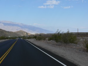
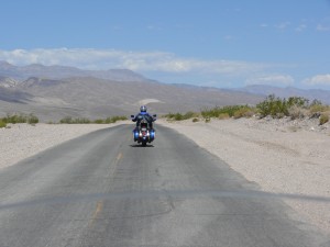
Now there were some neat stretches of road as we headed north through Nevada but for the most part this picture captures the essence of this leg of the journey.

Day 11, June 30th we packed up and were preparing to head out when we made a discovery. Dad’s bike had developed an oil leak at some point yesterday. The oil level appeared to be good. We planned to stop somewhere around Bend Oregon as we both were going to need tires but this little development would have to be monitored and may alter those plans. Out of Battle Mountain we took Interstate 80 to 95 north and a short distance later 140 west.

Highway 140 was a very nice drive and took us out of Nevada into Oregon. The plan was to take 140 to Klamath Falls and spend the night somewhere between there and Crater Lake and travel around Crater Lake and on to Bend to the tires the next day. Like I said that was the plan and plans being a bit like insurance rates, subject to change without notice, we had to adjust. The leak was going to need attention sooner rather than later. The only bike shop we could locate that would be able to help us was in Medford, Oregon. So out of Klamath Falls we continued west of hwy 140, which got more scenic the further west we travelled. We got to the bike shop and made arrangements for tires, oil changes and the necessary repairs to dad’s bike. My tires had to come from California overnight so an extra charge for that, more on that later. We found a nice motel and at about 6 we were done for the day having travelled about 720 kilometers.

Day 12, July 1 a down day. On different trips over the years I have been blessed with some exceptional service. Shops that appreciated you were a long way from home and on a bit of a time table and they seemed to go that extra mile to get you going on your way ASAP (I think of a Yamaha dealer in Corning NY I encountered in 1986, exceptional). This time, yeah not so much, so I will not mention the shop by name, maybe I have just been spoiled in the past. My bike got looked after fairly quickly to the tune of about $600 Canadian. Thanks to the overnight delivery charge for the tires the obscenely powerful Canadian dollar (not). Unfortunately by the time they got around to dad’s bike and diagnosed the problem they realized more parts were required and they would not be there until the next day. They had also discovered a small coolant leak. So it looks like we are down for a second day.

We had covered about 6000 kilometers to this point, I imagine about halfway. We have done a bit of zigzagging around that I hadn’t planned on so it was hard to know. It had been unbelievable to this point with a lot of spectacular things still to see. Nathan was into it more and appeared to be having a good time.

Day 13, July 2nd instead of sitting around the hotel all day it was decided, OK mom on a phone call suggested to dad, that we rent a car and go to California which was only a couple of hours away and not far south of the Oregon, California border, were some incredible redwood forests. Sounds like a good field trip to me.

We took Interstate 5 west and then hwy 199 south into California. We took some great pictures of the redwoods. I remember the first time I saw them in 1983 and it is difficult to describe to someone how big they are. I had stood beside a limb that had fallen from about one hundred feet up in the tree and it had a diameter almost equal to my height. A 6’ branch from 100’ feet up in the tree. I got some great shots of Nathan and dad standing at the base of a reasonably big one that we spotted.

North of Crescent City California

North of Crescent City California

We travelled to Crescent City and dipped our feet in the Pacific and got some more great shots. We travelled a short distance south along the scenic hwy 1 that follows most of the coast from the Canada, U.S border all the way down south of L.A. .

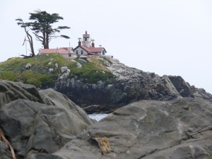
Crescent City California Lighthouse

Crescent City California Lighthouse

Awww shared a tootsie dip in the Pacific

Awww shared a tootsie dip in the Pacific

We headed back north along the same route and got back to the hotel in time to contact the bike shop and get an update. Dad’s bike should be ready in the morning.

ROUTE MAP DAYS 10 TO 13

Download file: 3Gen Day 10-13.gpx

Posted in Tours | Tagged , , , | Leave a comment