Well it might be a tad presumptuous of me to title this trip as “Epic”. I have read about a number of tours that deserve this designation (The Longest Ride: My Ten-Year 500,000 Mile Motorcycle Journey, published in 2007 or Jupiters Travels to name only two) however that in no way diminishes the use of epic for this little adventure. Maybe mini epic as we can’t all put life on pause for 10 years to travel the planet, not in my reality anyway.
The route is in the planning stage, I say that but I have set out in “Map Source” what I believe will likely be the final route. Anyone who tours knows that on the road there is always deviations that occur as, must see sights, you were unaware of present themselves in the moment.
I will not give away much at this point but I will say the journey will commencing in good old London, Ontario’s base of operations where there will be, at this point, 6 starting out on this trip. My dad will depart late May a couple days ahead of the rest of us so that he can visit his cousin in Colorado Springs for a day or two. The other 5 depart June 1 and will meet him there about June 3rd ish.
Somewhere in western Colorado, likely around Telluride, two from our merry band will regrettably have to turn north and toward the Deadwood area and the Badlands before turning east for home, not a bad compromise if you are unable to carry on west. The Deadwood area is amazing and they will no doubt have a great time. The remaining 4 will press on and have many days ahead. The trip is set for 30 days to account for some hiking in key spots in Colorado and Utah.
The western most point will be somewhere in California somewhere around Amboy after having passed through the Mohave Desert. There are so many very interesting things to see and do along this route. Don’t be at all surprised if a touristy photo of me surfaces wearing authentic Doc Holiday apparel and sporting 6 guns and a repeater rifle, a tribute to my fav character from the story of the Earps…..the Tombstone version of course…. “I’m your Huckleberry……. Why Johnny Ringo, you look like you’ve seen a ghost.” Some of Kilmer’s best acting. I digress.
The states to we will travel through include Colorado, Utah, Arizona, New Mexico, Nevada, California and Texas, by recent calculations the trip will include 17 states in all and we will cover about 11,000 km.
As we turn back north approaching the last third of the trip the highlight will be the Natchez Trace Parkway.
I plan to post almost daily so commencing June 1st check back and follow the adventure.
May 18th UPDATE
We have had two group meetings to discuss the route, maps, general safety and group riding issues (Late January and mid April).
When six riders are going to cover this kind of distance and be together for this long, I don’t care who you are, how long you have been friends or how close you are there are things that need to be discussed.
Such as 1) Has everyone taken the steps in the weeks or two prior to ensure that their steed is as mechanically GTG as one can expect. We know there will be the need for an oil change somewhere. Most have put fresh tires on which will get us through without having to worry about that hopefully. Although this distance is just about all I would get out of a set of tires. New tires when I safetied the bike in October and little ridding so far means they should make the entire trip.
2) Everyone’s feelings on camping verses motels. Either or both on any given day can be easily accommodated.
3) Meals…..I’m a reasonably early riser. When I travel alone I usually get underway ASAP and get an hour or so under my belt and find a spot to have breakfast. Lunch is usually an energy bar or fruit during a gas stop when the mood strikes me and of course hydrating frequently. The day usually involves stops for walks and photos but the next meal is normally dinner once I’ve stopped for the day. This way I cover some good distance and get to see a lot. I’m not on a meal tour, lunch is a time sucker. The question becomes, how does everyone else feel about that. Thankfully we are all on the same page.
4) Downtime. There is going to be a need for a “me” day a couple times throughout the trip where you do your own thing if only for a few hours.
Everyone is excited. Getting texts or emails almost daily….”I’m packed” …..”I’m ready” “can we go yet? and my favorite is the ones I occasionally get from Scotty counting down the sleeps before we leave.
Just a minor maintenance matter and currency exchange to sort out then pack and I too will be GTG.
Stay tuned for updates from the tour……..
FINALLY TIME TO RIDE yeeeee yaaaaa
***********************************************************************************
June 1st
London, Ont – Rockville Ind. 807km
Launch time pretty much as predicted 0700ish.
It was a tad cooler than expected and knowing how ridiculously hot it is going to be in a couple weeks when we are in Utah, Arizona and Texas it difficult to pack for every weather contingency. Be that as it may I had layered up to set out at 7 degrees using clothing I really didn’t expect to use, I would be proven wrong on this particular point within just a few days.
It was overcast most of the day but the threat of rain was minimal. This system had, for the most part, rained itself out the last couple days.
We crossed at Port Huron around 0800 with no issues. Course set, west on I69. This would be our go to highway for most of the day.
I wee misinterpretation of my GPS as we went from I69 to 465 which led to seeing slightly more of Indianapolis than perhaps we would have liked. Highway 36 west out of Indianapolis has changed dramatically since 09′ when I was through here last. Traffic was backed up as we made our journey away from Indianapolis toward Rockville.
The last 50km of 36 leading up to Rockville the sun made an appearance and in a matter of minutes the temperature went from 13 to 19, wonderful end to the day.
We had planned to camp in at the Raccoon Lake recreation area but the cool temp combined with the fact everything was still very wet from the rain in the past couple days and as RJ put it “I make too much to pitch a tent on the wet ground and shiver all night”. True enough. We managed to find a couple rooms at a nice little spot right in Rockville called the Parke Bridge Motel.
Parke County is most famous for being the home to the most covered bridges in the world and plays host to one of Indiana’s largest festivals every October. A solid days drive away it would be well worth the trip in the fall. The colours would incredible. I suspect one would have to plan well in advance for accommodation.
Unpacked, we set off to find sustenance and as luck would have it, did not have to travel far. We located a neat little spot on the main drag just a two minute walk from the motel, “Thirty Six Saloon”, we sat out on the patio or the “Hog Pit” as it is known. Two pints and a big meal for $15. lol.
Dan, assuming the role as tour ambassador was found making nice with one of the locals.
June 2nd
Rockville Ind. – Marysville Kn. 862km
A early morning photo op and we were off. A very nice day
The rivers day. This day would see us under most sunny skies with some overcast periods as we made our way west across Highway 36. We crossed the Illinois, the Mississippi and finally the Missouri rivers before we reached our stop for the night in Marysville Kansas. A historically significant location in the early days of the old west. I’ll speak more about that in tomorrow’s instalment.
We settled in at the Heritage Inn Express and had ……a diner dinner and Penny’s Diner. Penny’s was walking distance from the motel which put it on the short list. Penny, if there was indeed Penny, was asleep at the wheel apparently when it came to forecasting supply requirements. They were out of just about everything our group wanted and what we eventual received was a mite shy of gourmet. There were many, in the moment, laugh’s over dinner.
June 3
Marysville Kn. – Colorado Springs Co. 790km
As we rose on day three of our journey and looked to the north and west of the lovely Marysville Kansas it became clear quickly that this day would start out wet, very wet. It had not yet started to rain but the sky was dark and ominous in the direction we were heading.
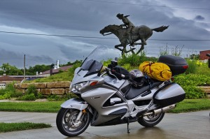
Our first stop was just a few blocks from the motel. The Pony Express monument and office/museum.
The Pony Express as active for about 19 months in 1860 and 1861 before it was replaced by the telegraph as a means of relaying messages. When active it ran messages, mail and small packages between St. Joseph’s Missouri to Sacramento California, a distance of almost 2000 miles. There were 400 horses spread out across 157 Express stations placed roughly 10 to 15 miles apart along the route. A rider would switch out his horse at every station and make 8 to 10 changes before the rider would swap out.
Our time admiring the monument and snapping pics was cut short when the skies opened up. We headed west with the rain teaming down and lightning striking around us. As exciting as it was riding along in the middle of a violent thunderstorm in the middle of Kansas the deer running across my path in the pouring rain as outstanding. I was told later by the other riders behind me that they were sure I was going to hit it. From where I sat it wasn’t that close but still, after my little event in “Pennsylvania Redux” I’ve had just about enough of these little creatures.
As we moved west the skies cleared and the remainder of the day was quite pleasant.
Passing through Oakley Kansas on HWY 83 we stopped and took a break, walked around the visitors centre complete with a giant bronze sculpture of Buffalo Bill.
Back on the road we headed west on 40 to 94 which is a beautiful and unique ride across the plains. A beautiful afternoon, great route and we arrived by the end of the day in Colorado Springs where we met up with my dad.
It has been three long riding days but we were on schedule. Now that we were all together we could begin to slow down and take in the sights ahead.
June 4
Colorado Springs Co. – Westcliffe Co. 292km
Now with the gang all together we headed out early in hopes of seeing the United States Air Force Academy Cadet Chapel. One of or crew has a son that recently graduated from the RMC (Royal Military College of Canada) and really wanted to see the chapel.
As we pulled into the entrance way at 0800, the time we had been told the chapel was open, there as a sign clearly indicating that access to the chapel did not begin until 0900. I explained our conundrum to the young guard, complete with AR15 or I guess M4 in America, his response was a flat toned and firm “I’m gonna need you to turn around sir” simultaneously a second young guard wandered in our direction. Not a whole lot of flexibility with these guys. So around we turned.
We were not prepared to wait around for an hour so the decision was made to move on. Next stop Garden of the Gods. We spent about an hour hiking around and snapping some pics.
Exiting the park we swung up through Manitou Springs, a beautiful touristy area nestle in a valley sandwiched between some incredible rocky cliffs. This route led us to our next stop, the ascent of Pikes Peek. It was a gorgeous sunny day for the climb to 14,115′ with lots of snow still at the higher elevations. We stopped and watch a group of guys launch off a short slope on their snowboards. About 750′ from the top we encountered a ranger parked across the road. apparently the parking lot and visitor reception area at the summit were still buried under 15′ of snow. Staff was working hard to dig their way in to the visitors centre to begin opening it for the season. The Pike’s Peak International Hill Climb was only a couple weeks away. In fact some teams had already arrived to survey the conditions and begin prep work on the machines. All this aside the view was extraordinary. We spent about a half an hour at this point before starting the trip back down, stopping at a few points to take in the view.
Back at the bottom we made our way back through Colorado Springs to Hwy 115 south passing the entrance to Norad’s famous Cheyenne Mountain installation. Prior to this trip I look into access even as far as the parking lot outside the main gate but was advised this was no longer permitted.
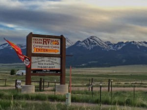
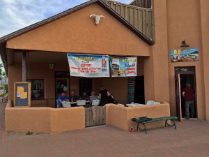
We continued south on 115 and then west on 50 to Hwy 69. This was a very interesting area with the section of 69 between Hwy 50 and Westcliffe being a twisty narrow road through rugged, rocky canyons. The ride along 69 conjured up thoughts of what it must have been like to navigate this on horseback barely 100 years ago. Not that long in the grand scheme of things. We stopped in Westcliffe and scouted out a good camping spot for the night. A very helpful woman in the local real estate office made a couple calls and directed us south on 69 out of Westcliffe just a few km to the Grape Creek RV Park nestled just a hand full of kilometres from where the foothills turned into an ascent of snow capped mountains. We registered at the camp ground and then returned to Westcillfe for an excellent dinner and a couple pints at Eduardo’s Restaurant.
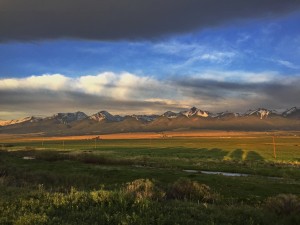
We got back to camp as the sun was beginning to set. The guys set up their tents. My dad and I opted for a cabin. The view from the camp was breath taking. It would be very easy to spend several days in this location watching the sun set over Electric or Cottonwood Mountains to the north west or to feel the heat of the sun hit your back on a cool morning while you watch the brilliance of the light hit Eureka Mountain to the south west.
June 5
Westcliffe Co. – Pagosa Springs Co. 402km
Our day began early heading south on 69 to 160 where we stop for gas and breakfast in Walsenburg. Our trip now turned west once again, this time on highway 160. This road holds many unique sights as it snakes its way across the south end of Colorado. Our first stop of the day as The Great Sand Dunes National Park and Preserve.
The park is located in the San Luis Valley on the western base of the Sangre de Cristo Mountain Range. The dunes were as melt from the mountain and its glaciers deposited sediment on the valley floor. water levels would drop in the summer months and the prevailing and would carry the sediment to the south west end of the valley where the dunes built up against the foothills of the mountains. Very unique and interesting indeed.
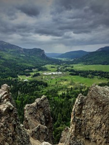
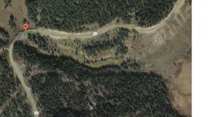
From here we headed west across the valley through Del Norte and South Fork and up into the San Juan Mountains. Riding over Wolf Creek pass on the Continental Divide at 10,857′ was spectacular. A few kilometres after Wolf Creek pass we began to descend into a valley. Part of the way down there was a pull out and parking lot with a view of the valley looking west toward Pagosa Springs. We stopped here and took in the view for quite some time. The weather began to cloud over rapidly so it was decided we should move on.
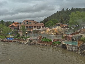
We were not under way very long and the skies opened up on us. We stopped in Pagosa Springs for the night at the Best Western Oak Ridge Lodge. After the rain let up a bit we took a walk over to the main street restaurant district, passing by a couple motels situated on the banks of the San Juan River where they had taken full advantage of the naturally occurring hot springs. Dozens of people were splashing around in pools, hots tubs and water falls. We had a great dinner at The Lost Cajun. I think we all agreed that the only place to get Cajun food as good as this would be to go to Louisiana.
A bowl of Chicken Creole Gumbo and a couple pints later and it was happy tummies for all. Not much more to do in Pagosa Springs on a rainy night so we retired to our room to go over maps of tomorrows route. Looking at the forecast and radar it was decided that we should book a motel in Ouray Col for the next night. This would likely be as far as we would get given that the day would be spent on the Million Dollar Highway (550) and would be the last days riding as a group. This would be a logical spot for RJ and Kevin to start their way homeward on June 7th. I called ahead a booked rooms at the Hot Springs Inn at the north end of Ouray, right on the Uncompahgre River.
June 6
Pagosa Springs Co. – Ouray Co. 220km
Though unseasonably cool at about 45 degrees F, we awoke to sunshine. T his did not bode well for the day ahead as we ascend and descend the passes of Hwy 550 between Durango and Ouray. The entire highway 500 runs from Bernalillo New Mexico to Montrose Colorado. The most famous stretch is from Durango to Ridgway Colorado. The section from Silverton to Ouray is part of the San Juan Skyway Scenic Byway. Also noteworthy if you’re in the area and have time the Durango and Silverton Narrow Gauge Railway is still in operation running tourists along the route first used to connect mining operations and move miners and ore up and down the valley.
The ride to Durango along 160 was pleasant but the skies became overcast as we turned north on 550. When it comes to the weather I know that what will be will be but I keep an eye on it when I travel because there is often an opportunity to alter routes if necessary. Particularly if it means dodging the severe weather one can encounter from time to time. At the very time of this trip a friend of mine was in another part of Colorado chasing tornado producing storms. In fact one touch down near Denver on the 5th of June. In this case an alternate route was not an option and the skies ahead were not inviting.
Navigating a stretch of highway with the reputation of being one of the most dangerous roads in North America under stormy skies as to say the least unsettling. It was however the only way to get where we needed to be.
We paused briefly at the side of the road just north of Durango to take in the scenery and to dawn our rain gear as it would clearly be a requirement. I noted the air temperature gauge on my bike indicating it was 12ºC as we got under way. The ride along 550 on a clear day is pound form pound one of the most incredible drives you could take in the U.S.. Last time we were here in 09′ I had such a drive. This time was to be a little different experience.
The ride up 550 will have you ascending and descending many mountain peeks but there are three in particular because of their elevation that are worth mentioning. In the first leg between Durango and Silverton the first high elevation pass we encountered was Coal Bank Pass at 10,640′. At Coal Bank Pass there is a parking lot to pull off and take in the view, on a day when there is a view to take in. As we approached the parking lot on our right side in was raining fairly steady so there was no point in stopping there. Right after the parking lot the road hits the highest point. There is an almost 180 degree turn and laid out ahead of you is a steep downhill with three curves in sight, left, then right then a sharper left which is off camber. Now ordinarily this would be no big deal. Remember how I mentioned I keep one eye on the temperature. As we approached Coal Bank Pass I had watched the gauge drop from 12ºC to 8º to 6º…..5º….3º and finally 2º. As I passed the parking lot and made the 180 degree turn at the summit the rain turned to sleet and on the downhill, off cambered turns laid out ahead of me I could already see it accumulating on the road. It was building up on my windscreen and the visor of my helmet.
Sooooo a quick assessment of the predicament was in order; 200+ lb rider perched atop a 730 lb (wet) motorcycle, plus gear. Two high tech rubber tires with 3″ to 5″ of contact with this little blue planet third from the sun designed to perform under conditions when the tires and road are warm (warmer the better) for maximum adhesion. Did I mention it was 2º Celsius and the road was covered with an ever thickening layer of sleet. With nowhere to pull over there was really only one option, get back down to an elevation where the sleet turned back to rain. I shifted down into first and let the engine slow the bike. I could see dad and JR were with me but I was unable to see passed JR. I had no idea where Dan, Kevin and Scot were. About 15 minutes and a half dozen downhill switchbacks later the sleet let up. We crossed Molas Pass at 10,970′ and found a spot to pull off at Molas Lake Campground. This was the first time since coming over Coal Bank Pass that I was able to look behind me, the other three were nowhere in sight. It was almost 10 minutes before the other three came into view. That was far and away the hairiest conditions I had ridden in.
We carried on toward Silverton. As we dropped down out of the mountain summit and toward Silverton we passed not one but two snow plows heading up. My guess is that the decision to keep moving had been the right one. If we had sat at the side of the road we would be cold, wet and stuck as the accumulation situation would not have improved.
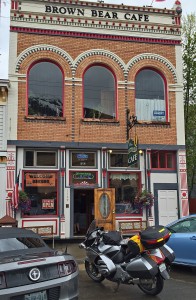
We stopped in Silverton (elevation 9,305′) and had a coffee and Bear at the Brown Bear Cafe, very cool spot. I bought a t-shirt in the official Harley Davidson store which enjoys the title of the world’s highest Harley Davidson store.
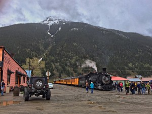
Just as we were preparing to suit up and move on the steam locomotive arrived with a load of tourists. We watched as they disembarked and milled around in the rain and mud covered streets near the train station. This would be a harsh place to live in the winter months. As a I recall only the main street was paved. Everything else….dirt.
Onward to Ouray and the last pass. Red Mountain Pass at the elevation of 11,018′ is the highest of the three and after what we had been through so far it was a bit worrisome. Worry being a waste of time we carried on. All we encountered in this leg was rain and a small amount of sleet which built up on the windscreen but not the road and it passed quickly.
As you drop abruptly down into Ouray through a series of switchbacks you get a great view of the uniqueness of this small town. Nestled or more accurately sandwiched in a narrow valley with high cliffs on either side it is a beautiful spot.
We settled in at the Hot Springs Inn and walked up town for dinner. Ouray is a very interesting town with an equally interesting history.
June 7
Ouray Co. – Cortez Co. 213km
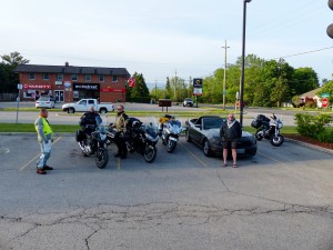
We were up early and packed the bikes. Some group photos were taken and then Kevin and John set off north toward Ridgway. They would continue north from there and head up toward the Badlands area of South Dakota before turn east toward home. Unfortunately they had to be back sooner than the rest of the group. I’ve been through some of the area they would be heading into and I’m certain they had quite an adventure.
Scot announced early that he was good to go.
At Ridgway we turned west on 62 once again climbing up into the mountains. I seem to be using or more accurately over using the word spectacular but when it fits, it fits. Connecting with 145 we head south through Placerville and back into the San Juan National Forest.
This little general store was a great spot to stretch our legs and grab a snack before the run down into Telluride.
On the ride into Telluride the skies changed a bit but thankfully as dramatic as it looked it was short lived and by the time we got into Telluride the sky had cleared off again.
Next to the San Miguel River with the Bridal Veil Falls in the background.
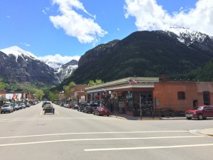
Shot down Telluride main street looking toward Bridal Veil Falls. We spent an hour or two in Telluride walking the streets and shops.
June 24th 1889 Telluride Colorado and the San Miguel Valley Bank although they didn’t know it at the time, would become known for the location of the first bank robbed by Butch Cassidy. The bank he physically robbed no longer exists. It was destroyed by fire just a couple of years later. It’s replacement can still be found on the main street.
We carried on south on 145 through Delores to Cortez, Colorado. We located the very nice Cortez/Mesa KOA camp next to Denny Lake.
As I sat looking out onto this vista waiting for my laundry to dry, my mind wandered as it had many times on this trip, wondering what many of these areas would have looked like 120 or 130 years ago. What it would have taken to survive out here with nothing but what you could carry on your horse. I know there are folks that still do this today but there is a difference in the the gear available today. They would have been interesting times.
When I took this picture it was late in the day and the temperature was in the 80’s. As the sun started to kiss the horizon I could feel the temperature dropping quickly. When we woke in the morning it was hovering just above freezing, about 2º Celsius. This further demonstrates my thoughts from the evening before. It would have taken a hardy, skilled individual to navigate these elements and this was far from the extreme conditions they would have faced.
June 8
Cortez co. – Mexican Hat Ut. 334km
A cool start to the day as mentioned above but warmed quickly as the sun rose. Our first destination today was Mesa Verde National Park. The first time I was here in 09′ it was a very foggy morning so we had no idea what scenery we were missing out on. This day was bright and clear and the ride up onto the Mesa was impressive.
Aside from the interesting geography of the Mesa’s they are best known for the large number of Anasazi Indian settlements secreted within the protection of the canyons provided by the Mesa’s. We went for a hike down into Cliff Palace.
The Anasazi farmed and lived on the mesa’s for about 600 years, then around 1190 they moved into pueblo’s built under the protection of the large overhanging cliffs. They lived here for about 100 years before migrating south essentially abandoning these settlements. Some feel that it was changing climate or hunting area depleting.
The ride down out of the park provided a different view of the surrounding landscape. off in the distance to the north was the backside of the snow capped mountains we passed through west of Ridgway yesterday morning. They provided an incredible backdrop for the comparably barren, rugged, dry and basically unforgiving.
We made our way south west to the Four Corners. A location where the highway passes through a spot where Colorado, Utah, Arizona and New Mexico meet. The actual geographic spot where this occurs is, a someone’s good fortune would have it, is just off the highway on private land where, for a small pittance, you can see a plaque in the group marking the precise location. This experience is often referred to on Trip Advisor as “a tourist trap”. We stopped outside the gates, snapped a pic and called it a day.
Next stop was Teec Nos Pos for gas and a quick look around the trading post located where Highways 160 and 64 meet. One of the oddities of travel in the U.S. was filling up with gas, something that is usually a relatively seamless and mundane task. Apparently there are trust issues in some areas and payment is required before nozzle kisses gas tank. Dan pulled in and started filling up at one of the pumps only to discover that he was pumping gas that someone else had just paid for. There was a little language barrier but in the end it all got sorted out and there was laughter…..well I giggled a bit.
From here we headed west on 160 ……again. There are other highways but this one runs through some exceptional geography. Then north on 191 and west on 163 to 261. Just a couple kilometres north on 261, which I missed in 09′, is 244 running off to the west and into Goosenecks State Park.
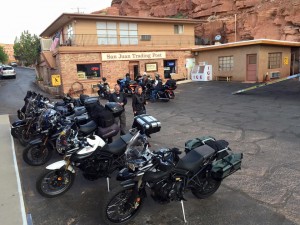
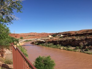
We spent an hour here looking around trying to grasp the forces of nature brought to bare to create this masterpiece. Dan and Scot opted to camp at this location. My dad and I opted for the San Juan Inn and Trading Post situated right on the San Juan River, complete with restaurant.
Turns out it is quite a popular spot. There as a large tour group of motorcyclists from Japan as well as other folks from various parts of the U.S..
June 9
Mexican Hat Ut. – Moab Ut 288km
We met up the guys at a gas station at the east end of Mexican Hat to fuel up and discuss the days route. Dan shared that the camping experience was interesting to say the least. Long after the sun had disappeared, Scot was nestled all snug in his covered hammock when in the pitch black curtain of night some species of nocturnal creature could heard moving around their camping area at one point passing under Scot brushing against his ass. An unsettling experience I’m sure. He played it pretty cool but I imagine he thought is was some sort of wiry, sleek killing machine with sharp claws and large gnashing teeth, alas we’ll never know, it didn’t like the scent apparently and moved on.
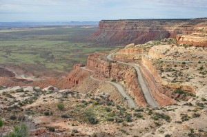
The plan was to head back east on 160 to Bluff and take 191 north to Moab where we would stop for the night and do some hiking in Arches National Park. We travelled east to where 160 intersected with Hwy 261 and I pulled over. I’ve travelled the route north on 261 before but Dan with his trailer and Scot with his car the dirt road that lay ahead with the climb up Moki Dugway was not an attractive proposition at all. We had discussed this before the trip began and agreed to bypass it. Now they we were here I felt a strong pull in that direction. I’ve been a lot of different places and I can’t explain it but this particular spot resonates with me. Dad agreed to lead them on the planned route. I set out on my own north to Moki. Highway 261 would take me north to 95 where I could travel east to 191 and meet up with them in Blanding.
I found this description of Moki which sums it up well;
” The Mokee (or Moki) Dugway, located on Utah Route 261 just north of Mexican Hat, Utah is a staggering, graded dirt switchback road carved into the face of the cliff edge of Cedar Mesa. It consists of 3 mil es of steep, unpaved, but well graded switchbacks (11% grade), which wind 1,200 feet from Cedar Mesa to the valley floor near Valley of the Gods.” (http://www.dangerousroads.org/north-america/usa/783-mokee-dugway-usa.html)
It is a truly magical place.
I met the guys in Blanding as planned. They had only been waiting about 20 minutes when I arrived. We carried on north through some interesting landscape on our way to Moab. We reached Moab in good time and got settled into the KOA camp.
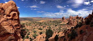
We carried on into Arches National Park….which quite frankly is difficult to explain in words. So its said that a picture is worth a thousand words with that in mind I’ll shut up and just go with some pics.
June 10
Moab Ut – Escalante Ut 386km
Early start to the day we went north on 191 to 70 then west to 24 and south to Hanksville. Overcast but a pleasant drive none the less. Interesting landscape but rather plain compared to the past few days. In Hanksville we fueled up at the famous Hollow Mountain.
From here it as west across 24 through Fruita. Initially known as Junction, likely because it is located at the confluence of the Fremont River and Sulphur Creek. It was first settled by a group of Mormon’s under the leadership of Nels Johnson. This area is located in a valley between two high cliffs. With the river running along the base of cliffs it creates and environment with lush vegetation. Idea for farming in a area otherwise quite desolate this was no doubt the reason Johnson settled here.
There are a couple of pull outs along this stretch of road as well where with just a short hike from the highway you can observe petroglyph’s on the cliff walls. There are believed to have been created by the Hopi, Paiute, and Pueblo Indians between 700 and 1200 AD.
Capitol Reef National Park was the next stop. The weather was on and off. Raining lightly one minute and blue sky the next. It made the decision on whether to ride deep into the park a difficult on. There is a significant danger of flash floods across the road in several locations. We had come a long way to not check it out though. Dan, Scot and I decided to give it a shot. I stopped in several spots to take pictures on the way in.
We all met at the south parking lot at which point the road transitions from paved to dirt and disappears into a narrow canyon with shear vertical cliffs shooting up on either side of the road. LAst time we were here it was quite dry so we ventured a distance down the road. Today this would have been unwise.
In the background of the above photo you can see where the road vanishes between the mountains.
A panoramic shot from where I was sitting.
This was taken as we left the parking lot and started back out of the park. You can see how this would be a bad spot to get caught when rain water raged through here. Judging from the sky there was potential for this before the day ended. Back near the entrance we found a hose and washed the red earth off the bikes.
We headed west on 24 to 12 where we turned south. Highway 12 is one extraordinary road, this stretch is among my favourite. This road is very diverse in both elevation and geography.
The above was taken along an elevated ridge with a view such as this off both side of the highway which travelled along this ridge for a few kilometres providing us with an incredible view. We navigated some very entertaining stretch of road. It would be very easy to send a couple days here going back and forth. Rain was looming frequently as you can plainly see but we managed to skirt around it until we stop for gas at the east end of the city of Escalante. We scoped out a motel, the Prospector Inn, would be our accommodation for the night. We got cleaned up and took a short walk up the street to the Cowboy Blues Restaurant. Returning back to the motel our view from the second floor balcony was a perfect place to watch an approaching an passing storm as we enjoyed a cigar and scotch and reminisce on the section of hwy 12 we had travelled this day.
June 11
Escalante Ut. – Zion Ut 352km
I remember my initial impression of Hwy 12 when travelling her in 09′. What struck me was just when I thought I’d been exposed to the most incredible scenery I had ever laid my eyes on I would round another corner only to be struck by a view of geography completely different and unique. From the bleach white rock of Escalante to the red rock along 12 on the way to Bryce Canyon National Park.
Our first stop for the day was Bryce Canyon. So many unbelievable vistas. We hiked here for an hour or so, shot some video and snap some shots knowing full well none of it would in any way be capable of capturing what nature had laid out before us. If a picture is worth a thousand words than being there was worth a billion.
Departing Bryce we again travelled west on 12 before turning south on 89. Travelling along 89 the traffic was moderate. Everyone was playing nice, moving along at just a little more than the speed limit, very reasonable. Everyone that is except the douche in the Porche that thought where ever it was he had to be was infinitely more important than everyone else’s safety. He blew by Scot, my dad, Dan, me and then a couple cars ahead of me, pushing hard to get back into our lane with the fast approaching oncoming traffic. The kind of stunt leaving you wishing you could catch up with him at the next fuel station but knowing that it is probably for the best you don’t. It would be difficult to talk your way out of what you are ride along thinking about doing to him. Then again this is Utah, maybe they’d be okay with it.
“Doctor Priddy Meeks settled the town of Winsor in 1864, at the site of present day Mount Carmel Junction, as part of Brigham Young‘s plan to settle all of Utah Territory.” (https://en.wikipedia.org/wiki/Mount_Carmel_Junction,_Utah)
This would be our stop for fuel before heading west into Zion.
Upon arriving at the east gate of Zion park we learned that all the camping within the park was booked on a first come first served basis and nothing was available so we back tracked and registered at the Zion Park RV and Campground. I took no pics at this location for one reason or another but courtesy of Google…..
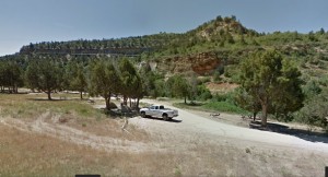
Our sites were under the trees to the left of the white truck (Google)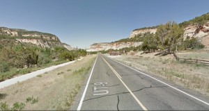 From the same stop looking toward the east gate of Zion (Google)
Once we got camp set up we headed into the park for some afternoon hiking. Dan, who has hiked Zion several times would be our guide for the afternoon. We took the bus ride from west gate ranger station up Zion Canyon Scenic Dr to the Zion Lodge. From there we hiked up to the Emerald Pools and then we had just enough time to board the bus up to the end of the road and hike the Riverside Walk along the Virgin River.

Looking north up the Virgin River from the end of the Riverside Walk trail. To go further you have to hike the river. Dangerous when there is a high water warning in effect.
June 12
Rising early Dan, Scot and I headed into the park for a day of some fairly strenuous hiking. we started with a short hike on our way in. Stopping east of the second tunnel we hiked The Great Arch trail. We perch ourselves on a rock ledge looking west down the valley as the sun came up. Wow!
Moving on we parked near the west gate again taking the bus up to Zion Lodge. We had breakfast here and then stocked up in water and Gatoraid for what was to come. We took the bus further up the canyon past the famous or perhaps infamous Walters Wiggle/Angel’s Landing hike. We felt if there was enough time we would do this one this afternoon.
We exited the bus at the trail head for the E Mesa Trail. The plan was to hike up the E Mesa Trail to where the Hidden Canyon Trial splits off. We reached this point only to find that Hidden Canyon was closed for repairs. Further up the E Mesa Trail we knew we could take the Observation Point Trail so we carried on. The closure of Hidden Canyon turned out to be a blessing as this was the most incredible hike I have ever been on.

E Mesa Trail about an hour into the three hour hike up to Observation Point. We were at the head of a group of hikers. This was taken with my iPhone. By the time I got my camera out annoying, noisy humans were crawling all over them.
The Observation Point hike was an 8 mile round trip with a 2100′ gain from the valley floor to the Point. The point is at 6508′ above sea level. True to what we had read it was about 3 hours to the top. Dan and I reached the top ahead of Scot. We had a bite to eat, hydrated and of course snap a few shots. I realized right about then that as much what and Gatoraid as I’d carried it was not going to be enough. Dan and I started back down and passed Scot coming up. Dan stopped to shoot an educational 🙂 video about the hike, I walked ahead slowly, stopped and talked to a couple folks on their way up. One woman was vacationing from Vancouver. About halfway down the sky started clouding over and there was some thunder. I really didn’t want to be on a narrow ledge in the middle of a storm so I picked up the pace a bit. Made it down in good time.
I got a text from my dad how had taken the day to ride around the area roads. He located a motel for that evening in Hurricane just a bit west of Zion.
Scot and Dan were opting to go back through Zion and camp for a second night. I still had to ride back out to the camp site, pack up the tent and ride back through the park to Hurricane so I carried on ahead.
It was an excellent day. I will return to Zion.
June 13
Hurricane Ut – Primm Nv 331km
Scot and Dan arrived after another night of chilly camping but raring to go. It was just a short distance before we jumped I15. Interstates are something I generally avoid like the plague but on this occasion it was the shortest distance between “A” and “B”, “B” being 169 to 167 leading around Lake Mead. Something none of us was unaware of and apparently as of the Google Maps 2011 view it did not exist but sometime since then up popped a park gate complete with rangers and for the nominal fee of $15 we were extended permission to navigate the most barren stretch of highway this side of Mars. I’ll reserve sharing the expletives bouncing around my corridors of my cranium. I can understand if your intent is to use the facilities but pretty steep to simply cut through. It is an interesting drive again unique terrain. Another route to consider would be to take I15 a bit further then the Valley of Fire Highway to where it meets 167 at the park entrance. You would still have to pay the fee but I think it would make for a more interesting drive then 169.
We made a rest stop in Henderson, grabbed a bite and hydrated. We have left the unseasonably cool weather of Colorado and the unsettled weather of Zion behind us, the temperature is climbing, it’s full on hot. It’s a dry heat though so it’s basically cool.
We head south on I15, rolling the dice a bit on what accommodation we might find. We found Primm, prior to 1996 it was called State Line because it sits on ….well….er….the state line between Nevada and California, clever. It’s economy is entirely supported by it’s three casino’s and virtually everyone that lives in Primm is employed at one of them. It was located near Lake Ivanpah which is more of a was a lake than an is a lake but it has made for a great location for the Lake Ivanpah Solar Electric Generating Station. The solar towers can be seen in the back ground of the photo below. It has an interesting history, Google it, its worthe read. All that aside it was located perfectly for us.
June 14
Primm Nv – Kingman Az 450km
Well and bright, beautiful morning. We were Mohave Dessert bound on this day. The next several days were predicted to be sunny and stinking hot and that’s just fine with our merry band.
Heading south on I15 to Nipton Rd where we head east briefly to Ivanpah Rd. Here we headed south through the Mohave Dessert.
How to describe the Mohave Dessert? Well I’m reminded of the opening scene from Casino when Pesci says “there’s a lot of holes in the dessert and there’s a lot of problems buried in those holes. Except you gotta do it right. you gotta have the hole already dug……”
No kidding, there is a lot of nothing out there. And yet somehow it that there is a beauty. Sort of like looking at the negative space in a work of art, seeing the beauty in what others overlook. Particularly in the early light of the day, the shadows cast from what little vegetation there is, if you can call it vegetation, makes for a interesting landscape. It’s a reminder that nature can survive, if it adapts, in even the harshest of environments. A good lesson for people.
South east on Ivanpha Rd to Morning Star Mine Rd then South east to what I will call the town of Cima. You have to be one tough individual to live and attempt to hammer out a life here.
In Cima we took the Kelso Cima Rd to the south to Kelso then to Kelbaker Rd where we continued south and passed underneath the Needles Hwy/Highway 40. We continued south on Kelbaker and although we left the official Mohave Dessert area I would say the terrain along Kelbarker as we moved south to where it intersects with the historic Route 66 was harsher, more barren and less forgiving than the Mohave.
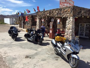
When we met with Route 66 we travelled west to Amboy and the history Roy’s Motel. We rested, fueled and had an interesting chat with the gentleman running the gas station next to the motel. He told us of a spot not far from there where the Marines had built mock villages to train for deployment to the east. At night you could see and hear artillery and small arms fire. It makes perfect sense because this area would be very similar to photos I’ve seen of some of the regions they are being deployed to.
As we left Amboy and travelled east on Route 66, for the first time since leaving home 14 days ago we were heading in the direction of home. We were not even half way in terms of kilometres yet but the direction was right. Unfortunately Route 66 is closed east bound at Kelbarker due to road conditions apparently. We cut back up Kelbarker to I40 and again east.
As we crossed from California into Arizona we crossed the Colorado River at the south end of Lost Lake. At this point we turned north on Oatman Topock Rd which is in fact the old Route 66 once again.
First stop along the route was where Oatman Topock Hwy and Oatman Rd converge. This was apparently also a convergence point for a couple of donkeys, standing in the middle of the highway in front the RV ahead of us and in no particular rush to go anywhere else. I guess because if you’re a donkey in these parts you don’t have many places to be.
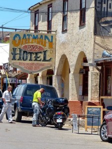
They eventually moved enough that we could all slip by. The next stop was Oatman and to say it is a unique town would be a gross understatement. There was a marauding band of hay munching donkeys roaming up and down the middle of the street. For the entertainment of the tourists and the pleasure of the donkeys, bags of hay pellets were conveniently available for sale in several of the shops lining the main street. According to my dad it hasn’t changed all that much since he was through here on his teen age adventure in 1958.
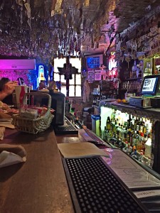
The dollar bill bar seemed as good a spot as any to get out of the heat, cool down with a pint and have a bite to eat. Lining much of real estate on the walls and ceilings are dollar bills left by patrons over the years. Many signed and dated. Its estimated that there is north of $100,000 pinned up around the premises.
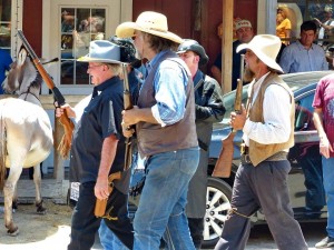
Back outdoors in the heat there was a drama unfolding. A mock shotgun wedding as carried out for the entertainment of the tourists.
Back on the road and head up out of Oatman in the rocky terrain I’m once again struck by what it would have been like to travel this area 100 years ago on horseback. Progress would have been much slower navigating over and around the rubble of the once much larger mountains. Clippity clop, clippity clop just you and your thoughts. Not much different than today in that way really. The often hypnotizing droning of the 1300cc inverse mounted V4 engine and my thoughts. Thoughts of career, family, decisions made both good and bad and decisions yet to be made. I really do need to come up with some sort of intercom voice activated recoding system because I find this time to be potentially creative. Unrecorded thoughts and ideas come and go and many are forgotten. This time spent, in my opinion, is better than a therapist. In fairness I shouldn’t make that comparison because I’ve never needed one. That would be a great title for a book, wait….Jeremy Kroeker already beat me to that idea.
Nuts….see…gotta write this stuff down :).
A little further on we crossed over Sitgreaves Pass. I’ve seen comments on trip advisor forums about the drive through this area and the cross of the pass. For those that would describe it as “not for the faint of heart” or “dangerous” I would suggest you may not have travelled very far.
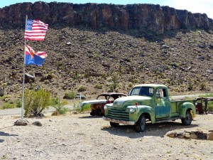
Cool Spring Cabins and Gas Station, what I’m certain would have been a thriving and welcome sight to the weary traveller back in the day is now an interesting roadside attraction.
A sort time later we popped out onto I40 and road into Kingman. Exiting at Beale St we quickly located a Motel 6 with a restaurant called the Calico right on the same parking lot. Settle in we took a short walk down the street to Metcalfe Park drawn there by the crowd that had gathered and the live music being performed.
Dinner at Calico’s and we were really to relax for the evening. I would certainly recommend this location.
June 15
Kingman – Winslow Az 495km
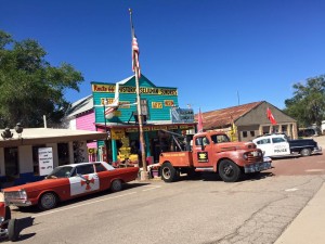
An early start and straight back onto route 66 north out of Kingman. Passing through such places as Hackberry, Valentine and Peach Springs, don’t blink, we finally arrive in Seligman. Seligman’s proximity to I40 has allowed to thrive comparative to many of the other smaller communities alone the Route.
There are couple of small touristy shops side by each as we pulled into town seemed like a good spot to stop. The one was owned and operated by a gentleman who started out life in Europe and after spending several years in law enforcement he moved to the U.S. just a hand full of years ago and bought into this business. Very interesting folks everywhere we stop. I believe it was Amanda Marshall that said “Everybody’s got a story”
Leaving Seligman we jump onto I40 and travel a short distance to 89 south toward Prescott. Just shy of Prescott we turn east on 89A and head up into the hills of the Kaibab National Forest.
At 5000′ above sea level and founded in the late 19 Century, Jerome owes its existence to the mining of gold, silver and copper that was carried out here. Built on the side of Cleopatra Hill its buildings are a testament to the ingenuity of the architects and builders involved in its construction.
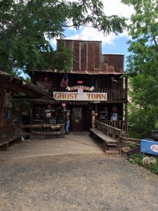
We had read about Jerome’s Ghost Town in a popular motorcycle touring magazine last winter so naturally it was going to be a stop. It did not disappoint, it was a fun stop.
Away from Jerome and down the hill on 89A to the valley floor we made our way onto Sedona. Sedona was a bit bigger, built up and busy than I had imagined it would be. There are interesting things to see and do in Sedona but the business really turned me off. We carried on, now north east on 89A. A fun ride, in particular the ascent after Pumphouse Wash. We eventually jumped back on I40 near Flagstaff and headed east. Passing places such as Twin Arrows and Two Guns before we turned south off I40 onto Meteor Crater Rd. Aptly named as it ends at a meteor crater. Known for long time as Canyon Diablo Crater it was renamed the Berringer Crater after Daniel Barringer (1860-1929). Barringer, a geologist, was best known as the first man to prove the existence of an impact crater on earth. The family stills owns the land on which the crater is found. We spent some time here looking around. There is a museum and tourist centre at the location which was quite educational.
There is a humorous story, well I guess that really hinges on your perspective, which occurred after Dan located my dad snoozing in the lobby. We’ll leave that for another time.
Back on the road the next stop was Winslow Az. It was late in the day so we opted for accommodation and dinner and left Standing on the Corner Park until the morning.
June 16
Winslow Az – Tucson Az 447km
Early start, we all met as usual loading our bikes in the parking lot. Dan announced that he was hearing the call from Utah and Zion, he would be leaving us this morning and heading back up into that area again.
We travelled the short distance to the south side of Winslow and Standing on the Corner Park. Impossible to not stand here and have the Eagle’s tune looping in your head.
Breakfast at where esle, Dar’s Route 66 Diner, just adjacent to the park. As we sat there I noticed three men sitting on the stools at the counter when something caught my eye. The guy in the middle, sharp dress cowboy type complete with hat wearing a large calibre, chrome plated semi auto pistol affixed to his right hip. It was at that point I sort of understood how this movement begins to perpetuate itself at this point. I have no idea who he is and I suddenly felt a bit uncomfortable and for a brief moment the notion that I too wished to be armed. Curious.
We finished eating, offered our goodbyes to Dan and parted company and then there were three.
We set out south on 87 which runs through the Apache Sitgreaves National Forest. A great mornings ride. We stayed south on 87 until it intersected with 188. Taking 188 south passes through the Tonto National Forest and some of the largest Saguaro cactus we would see on the trip. I should have stopped a photographed but I thought “oh we’ll see a lot more of these”, I was wrong .
From here we followed 188 to 60 and took 60 southeast to 177. Then 177 which eventually became 77 and led us into Tucson. It was a very warm, scratch that hot day, 120ºF +. We located the motorcycle shop we had scoped out as we realized the bikes were going to require oil changes at this point. Ride Now Powersports was our destination. It took a little navigation to find our way through Tucson and locate the shop. An appoint was made for the very next morning.
We were happy to finally get settled into a motel (La Quinta) and cool down. A short walk to a nearby restaurant for a steak and some happy tummies.
June 17
Tucson Az – Bisbee Az 155km
We arrived for our appointment at 9 am. Scot popped off to the local Ford dealer for an adjustment to his Mustang. This can be one of the downsides to such a long tour. You know you are going to need expected maintenance such as oil changes and perhaps tires and on occasion unanticipated repairs such as a rad issue I had on the Alaska trip. You are at the mercy of the good nature of the staff in the shop you happen upon. In this case the staff was great and we were done and on our way around 11. Not bad considering the fit us in to an already busy, booked schedule.
Heading south on S Kolb Rd we passed by the Davis Monthan Airforce Base. Acres and acres of decommissioned military aircraft. From the older A10 Warthog’s to more modern fighter jets and large military cargo carriers. Quite a sight.
Southeast on I10 and then south on 80 to the days first destination, Tombstone. Clearly a trip to this area had to include a visit to the historical Tombstone.
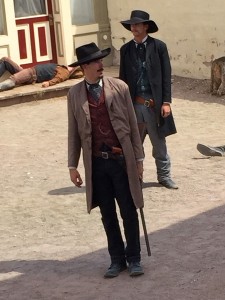
We parked in front of a cafe that was situated next to a rooming house that the Erp’s owned. We had a snack and a cool beverage in the cafe before taking a walk down the main street. We viewed a very informative video and took in a re-enactment of the OK Corral. Certainly very touristy but a must see for sure.
The sun was moving across the sky, as it has a tendency to do, a reminder that these moments are never as long as we would like them to be. It was time to move on.
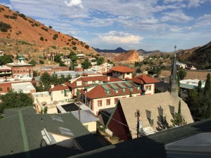
We continued south on 80 to Bisbee, a historical old mining town nestle in some rocky barren hills in southern Az. We stopped to look around and wandered into the Bisbee Mining and Historical Museum. Our destination for the night was to be Douglas Az until we spoke with staff in the museum and learned that the proximity of Douglas relative to border may not make it the best choice. I’ve articulated this a little nicer than she did. After looking around Bisbee it was decided that this would be our home for the night.
We checked out the historic Copper Queen and although it would have been a very cool place to stay for the evening it was a bit steep. We decided upon a spot suggested by the museum staff. The Gym Club Suites. An old large brick building that had been several things over the years but more recently renovated into condo’s before being re purposed as a motel, we managed a room on the top floor with a view of Bisbee from the balcony of the loft bedroom.
We wandered the streets, tipped a pint in an old tavern before relocating to a more mainstream restaurant across from the museum.
Back at our room a cigar and a scotch on the balcony was we watch the sun slowly disappear behind the hills at the west end of town.
June 18
Bisbee Az – Van Horn 580km
Southeast on 80 out of Bisbee bright and early. Arriving in Douglas it was clear fairly quickly that our advise from the night before was spot on. We found a spot for breakfast and picked up a few supplies before carrying on northeast out of Douglas on 80. We headed east off 80 on hwy 9.
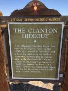
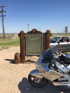
At Animas 9 takes a little jog north before heading east again. At that point we located the above historical sign post. As sure as I am that this was a legit hideout I’m sure they had many. It occurred to me that dotting a route with birth and death locations of some these infamous old west names would make for a spectacular tour.
We continued to follow 9 west. On multiple occasions 9 runs very close to the border with Mexico. We began seeing fences and dirt roads running parallel with the fence lines. On occasion we would see border patrol officers driving these fence roads.
Nearing El Paso we connected with Hwy 36 coming up out of Mexico this highway turns onto 178 and we followed it on into El Paso where we jumped on I10. Looking south from I10 passing through El Paso you can see across to Juarez and what a stark difference from one side of the border to the other.
We carried on along 10 out of El Paso, hot and barren, flat for the most part with remnants of what were most certainly well worn down ancient mountains in the distance. We stopped for the evening in a place called Van Horn.
Settle in at the Motel 6 we took a short walk down W Broadway St and found a suitable place for a nice steak dinner. Perfect end to a long hot day.
June 19
Van Horn – Del Rio 507km
The day began with a short stretch east on I10 before turning south on Hwy 118. I don’t recall how, why or when I decided on this highway but…..good call
Great ride south through some hilly country. We were surrounded by evidence of what had been one of the wettest seasons in a while. The landscape was far greener and more lush, well lush for this part of Texas anyway. This led us through a spot call Fort Davis. Designated a historic site in 1961 to protect one of the only and best remaining examples of a U.S. Army fort in the southwest. It is still in the process of being restored and we spent about an hour here walking the grounds and reading up on the history. Interesting location, clearly situated due to the geographical tactical advantage.
Moving south from here until we connected with Hwy 90 in Alpine and began travelling east. Following 90 this was a day more about the racking up some kilometres. Again sections of 90 lined with fence and dirt Border Patrol roads.
We stopped in Langtry situated along the banks of the Rio Bravo which separates the U.S. and Mexico. Langtry was in Val Verde County and prior to his death in 1903 Judge Roy Bean “The Hangin Judge” was the law in this unforgiving, forsaken landscape. He also operate a saloon and no doubt had his fingers in many revenue generating enterprises. Interesting times to be sure. Some of the buildings are preserved and some have been resorted accurately to the original structures. The judge makes for an interesting Wiki read.
Moving on from here we arrived in Del Rio by days end. Motel 6 on Veterans Blvd and a walk to a nearby Appleby’s for dinner was how this day would end for us. It would end differently for a couple other motel guests. When we returned after dinner and were sorting out the bikes for the evening a couple male guest were getting escorted away by Border Services. Whoops!
June 20
Del Rio – San Antonio 502km
An early start sounds a bit repetitive as most are. You can’t get anywhere laying around a motel room half the morning. We headed east on 90 to Brackettville where we turned north and jumped onto Hwy 334. I was back’n’forth via email with an administrator of the ST-Owners.com forum and he was from this area. Highly recommended Hwy 334, 335, 336 and 337. They weren’t all going to work out for us but we were able ride Hwy 334 to 55 and north to Camp Wood where we grabbed 337 east.
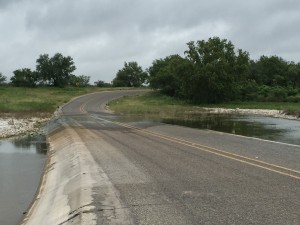
Hwy 334 or 337. Evidence that the road had recently been a river. Flash floods are to be taken very seriously.
We were able to ride 337 for a good distance and it was a ride that did not disappoint. We reached the intersection of 337 and 187 we stopped for gas and a stretch.
Back on the bikes a short distance south on 187, 337 continues east. We follow this great road just a bit further to Hwy 16 where we follow that into Bandera.
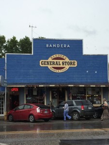
Bandera Tx has an interesting history that dates back to the mid 1700’s.
“BANDERA PASS. Bandera Pass is a narrow, V-shaped natural erosion cut in the long limestone ridge separating the Medina and Guadalupe valleys just south of the Bandera-Kerr county line. There a twentieth-century highway follows the route successively traversed for centuries by Indians, Spaniards, United States Army units,Texas Rangers, and cattle drovers.” (https://tshaonline.org/handbook/online/articles/rkb01)
Bandera calls itself the “Cowboy Capitol of the World”. The main street offers much in the way of shops and attractions. Much of the board walk style sidewalk is covered over. This would be particularly important to us on this day as it had been overcast and had begun raining when we stopped.

Ah ha…..an old fashion poker game being re-enacted, complete with a low down dog of a two time cheatin son of a gun.
Back in the saddle again we travelled east ish on 16 to 46 to Boerne Tx where we took Sisterdale Rd/County Rd 1376 north to Luckenbach Tx.
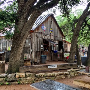
One cannot travel in this area and not stop in Luckenbach. How does one describe Luckenbach. The unincorporated town is located on loop off the highway that is a little more than a km long.
“Luckenbach’s population increased to a high of 492 in 1904, but by the 1960s, it was almost a ghost town. A newspaper advertisement offering “town — pop. 3 — for sale” led Hondo Crouch, a rancher and Texas folklorist, to buy Luckenbach for $30,000 in 1970, in partnership with Kathy Morgan and actor Guich Koock. Crouch used the town’s rights as a municipality to govern the dance hall as he saw fit.” https://en.wikipedia.org/wiki/Luckenbach,_Texas
While the weather was not co-operating, luck was on our side as related to the days festivities. The Thomas Michael Riley Music Festival was in full swing. It was very entertaining. There are a couple music venues on site. We hung out for an hour or so, took in a few of the acts and as it was getting on in the day and there were no accommodations nearby it was time to ride on.
We doubled back toward Boerne and jumped on I10 to make our way to San Antonio. As we road along we were in and out of the rain but the sky never gave way to anything that look promising until we were driving through San Antonio.
The clouds looked as though they may break to allow us a view of sunny skies but was to be short lived. My dad and I got separated from Scot briefly in the spaghetti like highway system of down town San Antonio.
Technology can be a wonderful thing. For as many of it’s negative aspects it sure made finding each other with a couple quick texts a simple task. La Quinta Inn and Suites at Bowie St and E Crockett St, a couple of blocks from the Alamo and the famous River Walk, perfect! We unloaded our bikes and dragged everything into the lobby as Scot arrived. The sky turned black, the wind picked up considerably and then the rain came, almost sideways. Timing is everything and today ours was pretty good.
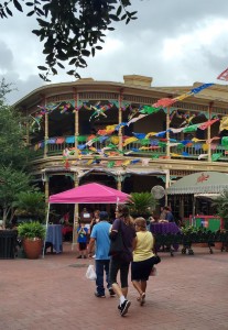
Once we got settled and cleaned up we noticed the rain had stopped. We elected to head out for a walk and found our way to River Walk. A truly unique area, a must if you make it this way. The River Walk is located below the grade of the surrounding buildings. Along the Walk you can enter the business at what would essentially otherwise be the basement level. So use your imagination as it relates to what such an area might smell like after a days worth of rain or several days as it was in this case. It wasn’t terribly unpleasant….it would simply be better in drier weather. Speaking with some of the restaurant staff we learned that this summer had been one of the wettest that anyone could remember.
We had a great walk and as usual a meal of outrageous portions. It’s a damn good thing I only eat breakfast, a small snack for lunch on these trips because dinner is usually enough for two reasonable people or one that wants to double their mass…….I do not.
Back at the hotel an evening of laundry, relaxing and digesting our feast.
June 21
San Antonio
We decided to have a down day and wander around the area starting with “The Alamo”. Certainly an interesting place to see once. Oh if the walls could talk. I’ve watched documentaries so I have some idea of what the walls inside the main buildings witnessed. We roamed the grounds for an hour or so reading through the material accompanying the exhibits.
As interesting as the Battle of the Alamo in 1836 is the story of it’s preservation and restoration as the city on San Antonio continues to thrive and expand around it. Stepping into the grounds is like stepping back in time…..if you can avert your eyes from being drawn to the much taller skyline of San Antonio looming beyond the walls.
From here we made our way along the Riverwalk toward the famous San Antonio Market Square and Produce Row.
Making our way to the west end of the Riverwalk we climb up to street level and onto Dolorosa/ W Market St. We rest for a while San Fernando Cathedral Square.
On we walk west on Dolorosa and right onto Produce Row of the market.
A little sun a torrential downpour followed by some more sun and a great lunch La Margarita Restaurant. The rest of the afternoon was spent wandering back along the Riverwalk to hotel. I am general not a fan of spending a whole lot of time in big cities on these trips but this was certainly worth making an exception.
June 22
San Antonio – Opelousas La 668km
June 23
Opelousas La – Tupelo Ms 631km
June 24
Tupelo Ms – Bowling Green KY 435km
Between 1836 and 1839 the a forced relocation of the people of the Cherokee Nation occurred from several states stretching from Tennessee to South Carolina. They were marched to the Indian Territory, the area now known as Oklahoma. The route they were moved along became known as “The Trail of Tears”
It was during this time that a young 14 year old Yuchi Indian, Te-lah-nay and her sister were taken from their home along the Tennessee River. Never being content with her relocation Te-lah-nay vowed to return to the home she’d been taken from. Almost as soon as they arrived in Indian Territory she slipped away and began her journey back.
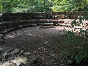
Her story was eventually recorded by a doctor/ writer who heard of her story and was compelled to document it. These documents are now the subject of a book and were the inspiration of the Wichahpi Wall constructed by Te-lah-nay’s great great grandson Tom Hendrix. Tom began building the wall 30 years ago at 50 years of age, transporting sandstone and limestone rock from the banks of the Tennessee River just a few miles away. It has been estimated that he has moved a million pounds of rock. This wall if stretch out in a straight line would be over a mile long. It varies in height and width. The wall in one part of the property commemorates Te-lah-nay’s journey back to her home in the Tennessee river area and the the wall on the other side of the property to her life after her return. Part of the wall was constructed to create a prayer circle. This is a very spiritual place and has attracted religious people from all over the world. Some local ministers attend this location for solitude and inspiration when preparing sermons.
My father and I had the honour of arriving at Mr. Hendrix’s property just after some other folks and we were extended the opportunity of sitting within the memorial he created while he recounted his great great grandmothers life and how it had deeply impacted him and moved him to create this monument to her.
He shares with us that he has “worn out three pick up trucks, 22 wheelbarrows, 3,700 pairs of gloves, three dogs and one old man.” He looks far from worn out to me and this stop was not only one of my favorite on this trip but quite possibly any trip I’ve taken.

Many people visiting the wall have brought stone to donate and add to the wall. There is rock her from all over the world. He has catalogue all of it.
Knowing this would be a stop on our tour I acquired a rock from a very unique location which I presented him. He took my name and information about where the rock came from and entered them in a journal.
I will most definitely return!
Alas it was time to move on. We had misplaced Scot. He texted me advising we turned into see the wall and he carried on toward Nashville where he would be spending 2 or 3 days on his own before making the final push home.
My father and I followed the Natchez a while longer then exited and jumped on ……
June 25
Bowling Green Ky – London, On 965 km

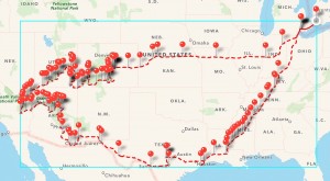













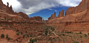


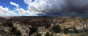
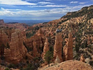


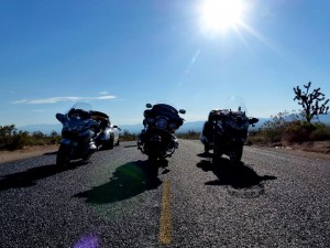










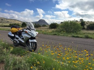





I think “epic” works! Can’t wait to get through Winter and get rolling on this one.