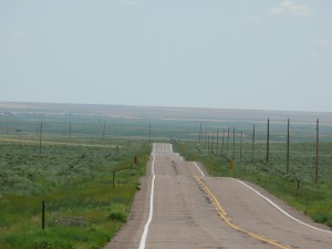
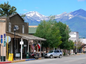
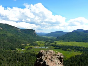
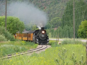
Day 4, June 23rd, we got an early start and stopped not much west of Dodge City at a marker for the Santa Fe Trail. I attempted to take some photos but they could not capture what could be clearly seen with the naked eye, wagon wheel ruts from the 1800’s across the open fields.
We continued west to Cimarron where we decided to head north on Hwy 23. We followed 23 north to Scott City. We stopped for gas and I ran into a young man named Mitch who was bicycling from San Francisco to Fort Wayne Indiana with a good friend and he would have to be a good friend to embark on a trip like this (www.crazyguyonabike.com/doc/youonlyliveonce). We took a few minutes to exchange some of our experiences. I wished him a safe trip and then we headed west on Hwy 96. We refueled in Tribute, Kansas where we spoke with a local retired farmer who had spent some time touring in an RV and had been through Ontario when he did a loop of Lake Superior with his wife. Prior to that trip she had not been out of the area around Tribute her entire life. Apparently she wasn’t all that excited about the trip. He joked about having her on a leash until they got far enough away that she couldn’t find her way home so she had to go with him.
We cut north on 285 at Eads, Colorado, then west on 40 at Kit Carson, then west on 94 toward Colorado Springs where we stayed with a cousin of my father.
While in Colorado Springs we hiked through the Garden of the Gods, unbelievably beautiful scenery and a foreshadowing of things to come. Lots of pictures and videos but they never truly capture the moment. I enjoy photography and once again striving for the perfect shot I venture off the trail and up the side of a steep incline looking for the perfect angle, the keeper pic., giving no thought to where I was. I reflected on this later that evening when my dad’s cousin talked about how careful they have to be with the family dogs because of the bear and mountain lions they have wandering their neighbourhood. Hum, note to self, remember you’re not in Ontario anymore.
Day 5, June 24th started with a ride through the Garden of the Gods as we put Colorado Springs behind us and headed southwest on hwy 115 under slightly overcast skies, but no rain. We followed 115 to 67 stopping in Wetmore at a small general store. We had been traveling through what I thought were mountains until I commented about the road and scenery to the women behind the counter and was told it was a nice drive that the locals use mostly to get to the mountains. We continued S/W on 96 from Wetmore and came out of the hills we were in and …wow…so those are mountains, looming in the background west of Silver Cliff. We then turned south on 69 and drove parallel with the mountains through some spectacular scenery.
I was using a Panasonic FZ5o bridge camera on this trip. It was capable taking some great quality photos as well as having a great zoom feature and its fully articulating rear display in conjunction with my throttlemeister cruise allowed for a few great shots when there just wsn’t time to pull over every 5 minutes ( you could easily fall into this trap and get nowhere).
Up to this point the scenery had been interesting at times but nothing that had really captured Nathan’s interest before now. We were passing by large ranges of buffalo, dozens of them where I got some really great pictures. At Walsenburg we had lunch then turned west on hwy 160. Dramatic changes in geography through this area which Nathan found very interesting. As we travelled west we were south of the mountain range we had just travelled along and passed through some very flat landscape. We passed within about 16 miles of the Great Sand Dunes National Park, (16 miles out of the way to the north) and elected not to check it out but in retrospect we should have. Then a short time later the road climbed up again as we passed over Wolf Pass at 10,550 feet before stopping at the San Juan Motel in Pagosa Springs, Colorado for the night.
Day 6, June 25th started with a mix of sun and cloud. We decided to continue west on 160 and stop in Durango before heading north on hwy 550, otherwise known as the Million Dollar Highway and we were about to find out why.
The stretch of 550 from Durango to Silverton is spectacular but pales when compared to the trip from Silverton to Ouray. Easy to see why this stretch of road rated an episode on the Discovery Channels ‘Dangerous Drives’, apparently ranked as the 5th most dangerous road in the United States.
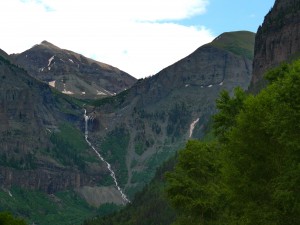
After lunch in Ouray we continued north and then west on 62 and south on 145 to the cut off to Telluride. Telluride was a must see in my book. A town nestled in a box canyon with a backdrop of gorgeous mountains, a thin high mountain stream and waterfall, not to mention it was the site of the first bank robbery by the outlaw Butch Cassidy.
It was raining as we rode out of Telluride, I imagined it might have been like this for Butch, minus of course the uncomfortable horse and the pursuing posse but other than that, similar but yet completely different. We took the first left, a road that began rising almost immediately to reveal some incredible scenery. Not long on the road we had to pull over and let three emergency vehicles pass by. Based on the terrain I was seeing, rock wall on one side of the road and guard rail and steep drop offs on the other, I figured that this couldn’t be a good sign. Within about ten minutes traffic slowed as we approached a left hand curve and as we rounded the bend there was debris all over the road and scrapes along the rock wall on the inside of the curve and a short distance away a car on its roof. Everyone was out of it and seemed fine. It could have been a lot worse. This road eventually connected back to 145 and we headed south passing through Rico a once thriving mining community now little more than a shadow of what it once was. As we continued south toward Delores the terrain began to flatten out and the sun came out. We eventually made our way to the Budget Host Inn in Cortez, Colorado. From the motel we could see the mesa’s of Mesa Verde National Park. The sight of the mesa’s was intensified by the black storm clouds and lightening blowing in over top of them, quite an impressive backdrop. That was our first glimpse at what turned out to be a very windy and intense, albeit it short lived, afternoon thunderstorm.
A long day today, on the road at 6:30 and we finally parked the bikes at 4:30; lots of stops and lots of incredible sights.
ROUTE MAP DAYS 4 TO 6


