Day 14, July 3rd I took dad to the shop for 10 am and returned to the hotel to shuttle all his gear over in hopes we could shave some time off and get away quicker once his bike was ready. Nathan and I got packed and headed out to meet him. Guess what, 1100 became 1:30 in the afternoon, I guess lunch and stuff got in the way. As I alluded to earlier, not typical of the service I have experienced before. As we waited we got talking to a couple of other guys waiting for their bikes and as it turned out they were from Victoria B.C. but one of them had grown up in London not far from where I did and he attended a rival high school, small world.
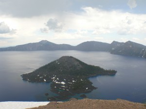
We travelled out of Medford on hwy 62 north and then east to the entrance to Crater Lake. It was a hot humid drive with the temperature rising to about 100. As we entered the Crater Lake area it began to cloud over and as we ascended up to the lake ring road the temperature dropped to 60. We got a few nice photos but our time here was short lived as a storm rolled in and we decided to press on so as not to get caught. Issue two was that there was one or two maybe, oh, a trillion mosquitoes that were out to drain anything they could sink their pointy little proboscis into.
We travelled around the west portion of the ring road and down the north side to hwy 138 then west to hwy 97 north.
Just south of Bend we took a bypass that came out on hwy 126 near Powell Butte. Then east (whoa east that must mean something) to Prineville, Oregon where we found a great western style motel called the Rustlers Inn. We kicked back after dinner with a cigar and beer; I think I could get used to doing this for a living.
Day 15, July 4th following hwy 26 east out of Prineville leads through the Ochoco National Forest and past the John Day Fossil Beds National Monument. The discovery and study of fossils in this area began in 1881 when fossilized remains of a rhinoceros where discovered during an army expedition. John Day, after which a river and nearby town are also named, was a member of the Astor Expedition that passed through this area in 1810-1812.
A bit N/E of Prairie City we took hwy 7 toward Baker City where we continued N/E on hwy 86 stopping in Richland for lunch. We got talking to the waitress and found out she was Canadian, born in Alberta in the same town as dad’s cousin Barbara Nelson, once again, small world.
The next leg of our little journey would take us on a 44 mile round trip north along the east bank of the Snake River to the Hell’s Canyon Dam. This is right on the Oregon and Idaho border and is a must see when in the area. It was easy to find because I had it in the GPS. Otherwise the map I had lacked in detail and it might have been a bit trickier to find the road. I got a number of good pictures and used the GoPro to video the entire trip out.
Now south on hwy 71 a very exciting, twisty stretch of road that runs south along the Snake River for a bit before breaking away S/E just south of the Brownlee Dam. In Cambridge we took hwy 95 toward Council. The weather was getting a bit questionable looking and we did get rain on a bit north of Council. Thankfully it didn’t last long. With it being July 4th the area was very busy. We took hwy 55 south near New Meadows to McCall which is a resort community on Payette Lake much like a number of small towns you could find up around Huntsville or Bracebridge here in Ontario.
Everything in McCall was booked but we managed to find a nice B&B (Meadowood Lodge) for the night north of McCall so we had to double back a short distance. We lucked out again I would highly recommend this lodge if in the area. They could accommodate a fairly large group if arrangements were made ahead of time.
Day 16, July 5th began at 6:30 with washing the bikes before anyone was up. We had a nice breakfast and bid our hosts adieu and we were off south of 55 toward Boise, a beautiful drive down out of the mountains.
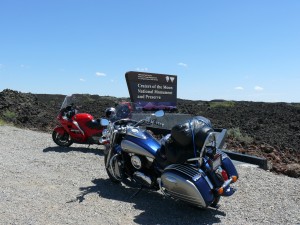
It had been recommended to me before the trip that once in Boise we take hwy 21 north east back up into the mountains then hwy 75 down through Sawtooth National Recreation Area but we decided not to and opted on taking Interstate 84 and cut off on hwy 20 and connecting with hwy 26 in Carey. We turned and headed toward Arco stopping several times to take pictures as we entered the lava beds of Craters of the Moon National Monument. We actually went into the park and did a loop the park road through the lava fields. This was ten different kinds of cool. The soil, if you could call it that, was course granulates of lava rock. Nathan and I climbed a very high mound of this lava granulate in the middle of the park and the view was amazing.
In Arco we headed east on 20/26 to Idaho Falls where we spend the night at the Red Lion Hotel next to the Snake River. We had a great dinner at the Brownstone Restaurant just down the street from the hotel. We ate out of the patio with a view of the park and Snake River across the street.
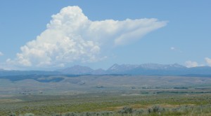
A nasty looking storm rolled in overnight again seemed to miss us. We have been ridiculously fortunate when it comes to avoid bad weather.
Day 17, July 6th I looked out and saw a group of people unloading bicycles from a cube van. Dad was already down packing his bike and I could see him talking to them. Over breakfast he explained how there were 65 cyclists in all and some had already set out this morning. They had been planning this trip for about 5 years and were travelling from somewhere in Oregon to New Hampshire. Their journey was actually going to take them through London around July 31st, there’s that, it’s a small world thing again.
We headed out of Idaho Falls on hwy 26 and deviated from the set route by taking hwy 31 in Swan Valley. We had passed a lot of the cyclists as we had made our way to that point. It was a very windy morning and for the cyclists it would have been ugly, sort of a head/ cross wind. I’ve been in their shoes and it ain’t fun but the scenery would make it a bit easier to handle.
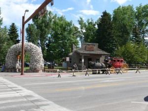
Highway 31 brought us into a small town called Victor and from there we took 33/22 through the Bridger-Teton National Forest to Jackson, Wyoming. Oh man the scenery was amazing with the Tetons off to the north as you descend into Jackson. Jackson itself….a bit commercial but interesting and we parked and did the touristy thing because …well we were tourists so we checked out some shops.
Leaving Jackson we took hwy 191 and then 287 into the Grand Teton National Park which eventually led us into Yellowstone.
There was a fare bit of construction in parts of the park and the going was a bit slow at times but that was great for taking in the scenery and there was no shortage of that.
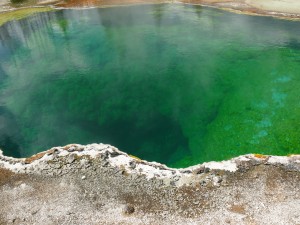
We stopped and hiked around for a bit at the West Thumb geyser basin. Looking off across Lake Yellowstone there appeared to be some miserable weather off to the east toward Cody, Wyoming. I got some really interesting pictures of the thermal pools which tip the thermometer in excess to 170 degrees Fahrenheit, apparently not an appropriate substitute for a hot tub.
I talked to some other bikers here who had entered into the park from Cody and as I had previously predicted they had encountered some awful conditions complete with high winds, hail, rain and lightning. He looked a bit irritated when I told him we had missed it all.
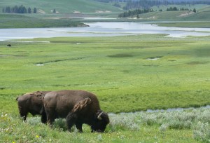
Continuing from there we made our way toward Fishing Bridge where we turned north off 287. I believe that this was hwy 212 and it was on this stretch of highway running along the Lamar River that we got our first up close and personal look at Buffalo, lots and lots of them. With that came some wonder photo ops again.
We eventually made our way out of the park to our resting place for the evening in Cooke City, Montana. We had considered going over the top of Bear Tooth Pass and staying in Red Lodge, Montana but decided against it as it was a bit late in the day and the weather ahead looked sketchy.
ROUTE MAP DAYS 14 TO 17


