
Story to follow.
5551 km…..give or take. Map to follow


Story to follow.
5551 km…..give or take. Map to follow
This was a fall ride with a group of folks I travel with from time to time.
Three days, great weather and incredible colours with the change in seasons. More on the route to follow.
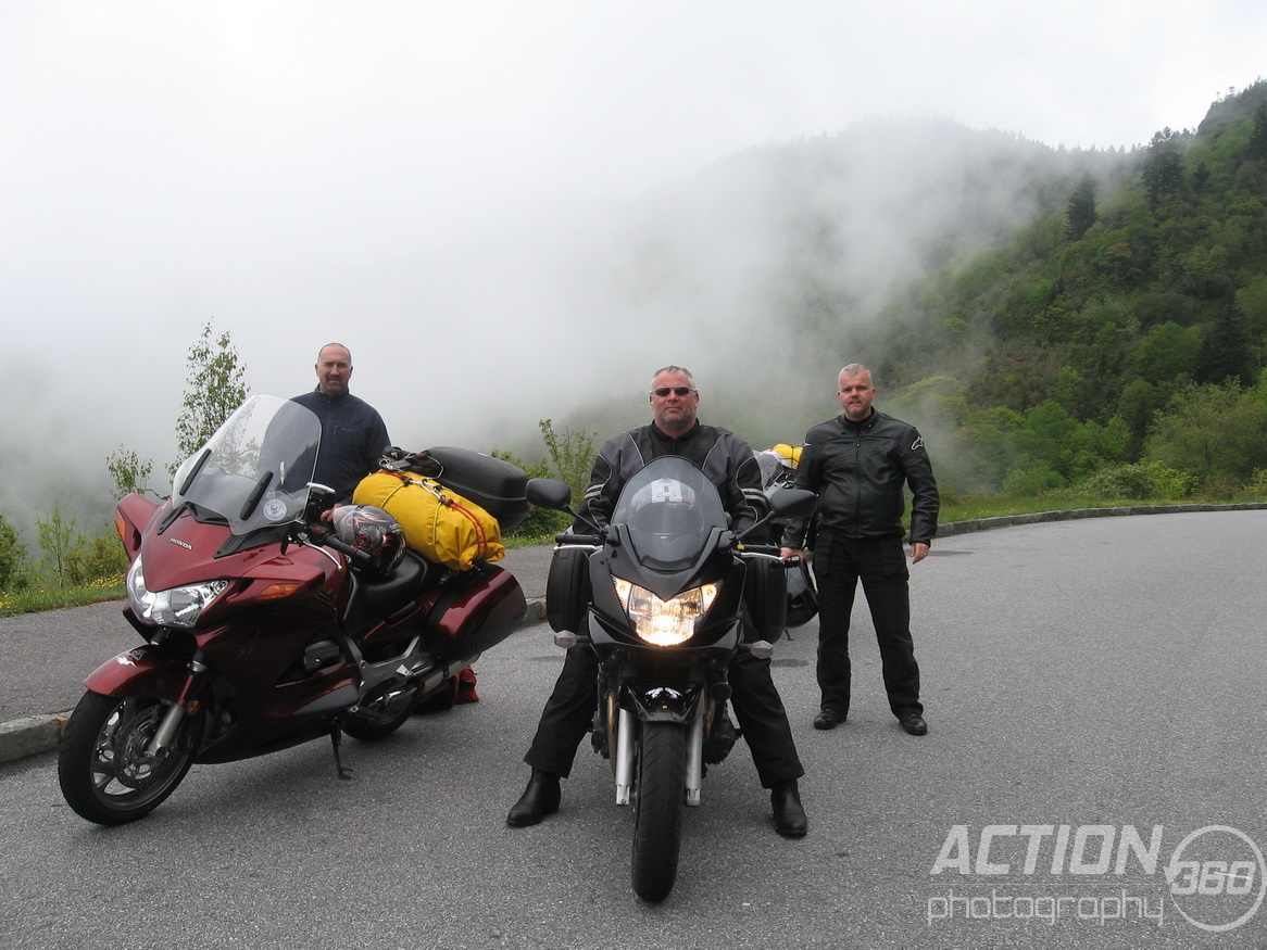
This 2012 tour saw the three amigos depart London, Ontario on the morning of May 20th. It was a beautiful day of riding on I75 with an unexpected detour just short of Knoxville because a section of I75 decided it would rather occupy space in the bottom of an adjacent ravine. As exciting as this was for the section of the highway involved it was less than desirable for anyone wanting to get to Knoxville, pretty inconsiderate of the highway I think.
We stayed just north of Knoxville in Lake City the first night as this was to be our launching point for the “Devil’s Triangle” the morning of day two.

Day 2 we rode the Devil’s Triangle and south through Oakridge Tennessee and onward to the Tail of the Dragon. It was the perfect time of year. A wonderful blend of sunny skies and lack of smokey presents on the Tail. None of us had any notion of doing our best Isle of Man impression but the posted speed limit…..on a motorcycle…..on the Tail of the Dragon…..seriously!
From there we made our way south and then west along the Cherohala Skyway looping around south at Tellico Plains and eventually east before stopping for the night in Murphy.
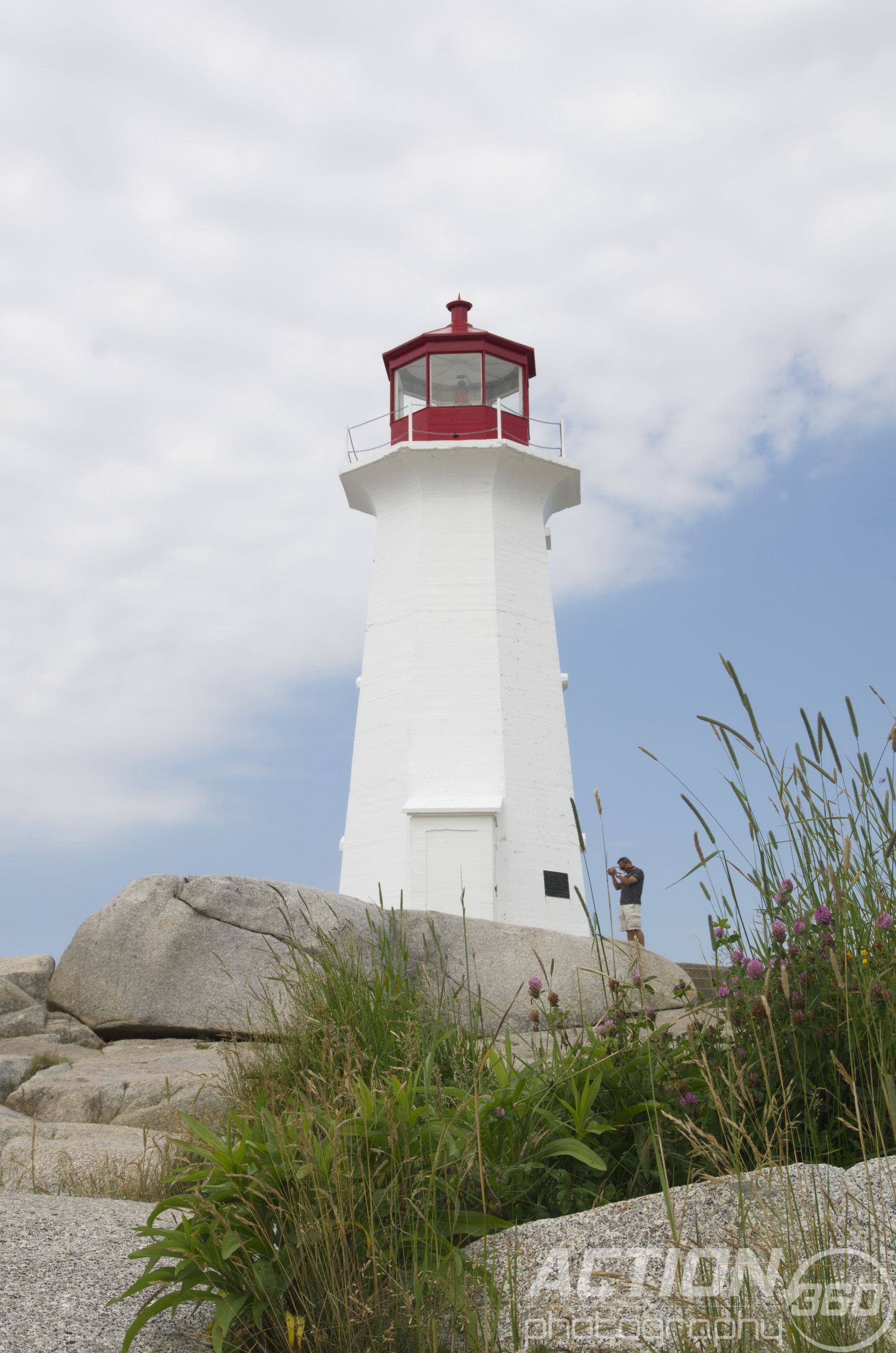
On the advice of the motel clerk we took the short (apparently the clerk has distance issues) walk to this little spot. Awesome! On the walk back we stopped at the gas bar/ variety store next door and made a purchase of liquid refreshments with which to toast the success of the trip thus far.

Day 3 we rode back north along a section of Moonshiners Run and the Tail of the Dragon in reverse (and then some). We carried on from there back toward Knoxville but bearing to the east we took the Foothills Parkway and found ourselves by that evening in Gatlinburg or what I like to refer to as Niagara of the south.


Here on the right you’ll note the entrance to this little strip mall off the south west side of the street where we were delighted to find a moonshine outlet where you could actually sample the many flavours that presently defining this libation, Marin “Popcorn” Sutton would roll over in his grave, because everyone knows real moonshine has one flavour, “cough, cough sputter, holy crap!”
We tried a couple of the flavoured samples but then insisted on a sample of the punch in the guts stuff. Whoooooeee! it does have a bit of a punch. I’ll stick with Scotch. Would loved to have been able to fit a bottle somewhere to bring home. Alas one of the coms to motorcycle travel sometimes.
We left here the next morning and went south up onto the Blue Ridge Parkway near Cherokee and then east.
We followed the parkway most of the day. We donned our rain gear early thinking it looked like rain but shed it near Asheville as the sun made an appearance. Notice I said appearance, it was short lived. This is the second time I have been on the parkway and other than the beautiful twisty roads I still have yet to see the wonderful scenery because once again it was overcast and eventually raining.
Now the rain, that is a curious story. One moment I am riding along the road under a canopy of beautifully lush trees, with the occasional glimpse of a rock face to my left and shear drop off to my right, looking at the sky overhead thinking “hey we might just be OK.” Then suddenly, the road executes this extraordinary 180 turn around the end of a rock outcropping and we are instantly heading in the opposite direction and the view overhead was remarkably different, within a minute a downpour . Now if you are familiar with the parkway then you know a downpour here redefines the amount of rain one would expect could possible drop from the sky at one time. The phrase falling in buckets doesn’t really do it justice. There was nowhere to pull over so the option that remained, however unpleasant, was to get really wet and learned to love it so I rode on.
It was moments later I notice that the other two amigos were no longer behind me but with all the twists and turns they could be just a few seconds behind me and it would be hard to know. With no place to pull over I carried on to a point where the trees opened up along a ridge in the mountains and a strategically positioned tourist information building beside the roadway. I dismounted and sought cover under the overhang of the building to take inventory of current level of saturation, turns out it was considerable. I looked back down the road for my partners…..5 minutes….10 minutes….. clearly they had noticed a spot to pull over that I had not. About 15 minutes later they pulled it, dismounted and one walked right by me and into the men’s room . The other brought me up to speed on their activities in the past 15 minutes of our journey. Apparently they had astutely observed a pull out for a picnic area and surmising that such an area must come complete with shelter and not be too far off the roadway they elected to check it out. Well they were wrong on both counts but dismounted their bikes nonetheless to see if there was anything that could be done to prevent from getting any wetter than they were. It was at this point the other rider, who shall only be identified cryptically as JR, peeled of his leather gloves and caught up in the excitement of the moment, balled them up and fired them through the trees and over the edge of a cliff. Highly therapeutic he would later share with me as they would no longer serve much purpose as a comfy riding glove anyway.
We dried off as best we could and carried on through the rain taking in the Diamondback south out of Little Switzerland. This was enjoyable but would have been awesome under drier road conditions. A short section of highway by any definition but very nice and fairly recently repaved. We got separated somehow along this stretch of road, my fault entirely but with the miracle of the modern cell phone we got reunited in Boone for the evening.

The next morning we headed north out of Boone along 421 “The Snake” toward Shaddy Valley. We actually stayed on this road all day as it weaved through the countryside all the way back to Richmond, Kentucky. This was an amazing stretch of road but a very long day. A must if in the area. By the end of this day we were praying for straight road.

The last day was spent on I75 north and the push home.
Great company, incredible route, awesome trip!
Enjoy the video and soon I hope to post the map of the route.
Remember, ride far, ride responsibly fast (if that’s your thing) but most of all RIDE!

Near Hazelton BC. Seven Sisters in the background

Approaching Prince Rupert BC

Hazelton BC

Saskatchewan Crossing

Emerald Lake BC
Three Generations – 18 States – 21 Days – 12,200 km My father has spent much of his adult life as a motorcycle enthusiast. He has traveled extensively throughout Canada and the U.S. and has been through most of the areas this trip was going to cover. His trusted steed for this journey was a 2005 Kawasaki, Nomad. I started riding off road at age 12 and other than a small hiatus from riding when my children were young I have been riding for over thirty years. The longest trip prior to this that I had ever been on was when I took off at age 21 and went to British Columbia and down the west coast to California on my own. It was a little over 11,000 km, nothing in the way of what I would consider a long trip since that time. My ride of choice on this epic adventure was a 1997 Honda ST 1100. The third generation in this family adventure was my 18 year old son, Nathan. No motorcycle license and no interest in going on the trip up until about a month before hand which created a tense moment or two as I scrambled to secure a passport for him and rethink how to redistribute everything we needed to carry. The vision for this trip began long before the journey. Conversations started a year before and researching the route in earnest about 6 months before. One goal I had was to document the trip extensively, influenced in no small part by Ewan and Charlie and their epic adventures in “A Long Way Round” and “A Long Way Down” which I watched during the winter leading up to the trip. I didn’t quite have their resources but I had my Panasonic FZ50 digital camera, a small handheld JVC Everio video camera and a recently acquired GoPro Hero camera which I mounted on my helmet. Knowing that this route could have afford an abundance of potentially amazing sights we set a goal to visit at least one major point of interest in each state. Using maps of each state I plotted a GPS route which, as it turns out, was very helpful. Having said that let’s face it, the GPS is great, it is compact and convenient, unbelievably handy when it comes to finding food, lodging and fuel (especially fuel) but it does have its limitations and when it comes to picking a route there is no substitute for a good detailed map that you can lay out in front of you. As I selected the route I used the detailed maps to connect one recommended scenic road after another. Stringing these roads together in this fashion made for a trip filled with days that were almost an overload to the senses. There were a number of days where we passed scenery so unique that I remember thinking, “well that’s it, that is my favourite part of the trip, it can’t possibly get more beautiful than that”, only to be proven wrong just around the next turn. For me this was particularly true in Utah, a state I will most certainly return to. By now I’m sure some of you are thinking yeah great, got it, nice back story what about the trip, the route, the miles under your belt, get on with it. Patience is a virtue you know but yes the trip:
Day 1, June 20th, 2009 saw us up at 6 am and with a couple of unexpected matters to resolve, mostly associated to the rain we hoped wouldn’t come, we were on the road about 7:45. The rain stuck with us as we left London, Ontario and traveled west and crossed over into the U.S. at Sarnia/ Port Huron and from there south west toward Indianapolis. As we plodded along in the rain we were passed by the University of Western Ontario, Mustangs Football, tour bus. Then we passed it. Then it passed us. The last time we saw it was around Fort Wayne Indiana. Interesting only because my dad worked at the university. The next day we learned that the bus was carrying the London Silverbacks semi pro football team and it had been involved in a serious head on collision with a SUV not long after we passed it. Passengers of the bus sustained minor injuries but unfortunately the driver of the SUV died. Around 11:00 the rain stopped, the sky cleared and the temperature rose to 95+. It was became a very pleasant day. We bypassed Indianapolis and took Highway 36 west. A route dotted with small towns and scenery not unlike Ontario. We eventually arrived in Rockville, Indiana a very pretty town in Parke County best known apparently for the numerous (31 if anyone is counting) covered bridges that occupy the nearby countryside around Rockville. If fact of the 98 historic covered bridges in Indiana 51 are in Parke County and the surround 6 counties. We traveled a little over 800 km; a good first day. We found very nice accommodation at a place called the Bubble Gum Bed & Breakfast. We would recommend this one. http://en.wikipedia.org/wiki/List_of_Indiana_covered_bridges
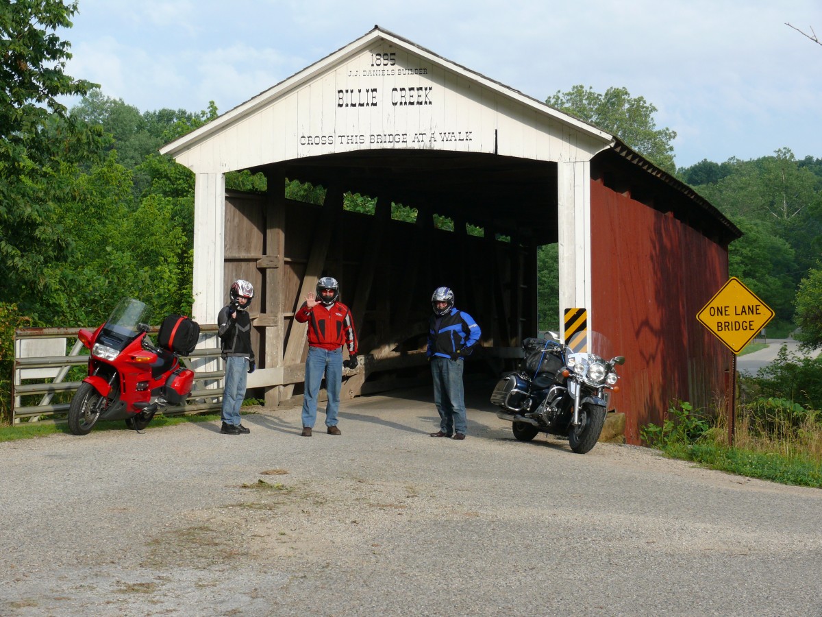
Rockville Ind.
Day 2, June 21st began with a wonderful country style breakfast and a bit of an embarrassing moment. I ladled out myself some cream of wheat porridge, I then had a spoonful of the worst tasting porridge I had ever experienced in my life. It was just about that time when our hostess entered the room carrying a nice little basket of biscuits, being a bit of a student of body language; I immediately identified the look on her face as one of confusion, wondering why on earth I was eating a spoonful of gravy. I had never had biscuits and gravy before and as good as it was, out of respect for my coronary arteries that will also be the last time. Our bellies full from a great breakfast we set out and toured around Rockville on a wee tour. After a couple of photo ops we drove across one of the covered bridges and then we were off, west on Hwy 36 into Illinois and then across the Mississippi into Missouri. We stopped just after we crossed the Mississippi at Hannibal and took a moment or two to look at a monument about the journeys of Louis and Clark. We crossed Missouri and turn southwest at St. Joseph’s on Hwy 59/4. For a short distance out of St Joseph’s we road parallel to a railway track with quite possible the longest freight train I have ever seen.

Day two drew to a successful conclusion with our arrival in Topeka, Kansas, we traveled 833km under mostly sunny and increasingly warmer skies.
Day 3, June 22nd we got an early start and headed south on the Interstate only a short distance then got off and headed southwest on Hwy 50. Once we got a few kilometers under our belts we stopped for breakfast. The waitress told us about a fully restored old courthouse in Cottonwood just a short distance away so we checked that out. It was a very nice town with some of the original cobblestone streets in the core of the town. Then back on 50 we took a short detour north on 177 to check out a bit of the Tallgrass Prairie Natural Reserve before continuing west on Hwy 50. We passed by Hutchinson where there are massive underground salt mines. Not sure how they compare to the salt mines under Lake Huron at Goderich, Ontario. We traveled west to Pratt where we took 400/54 west to Greensburg, Kansas. Greensburg was the scene of an EF5 Tornado on May 4th 2007. This tornado was 1.7 miles in diameter and had winds of 200 miles per hour. It “swallowed the whole town in one gulp destroying 95% of the buildings in Greensburg. Twelve people, out of 1,400 residents, died”. I have never seen destruction like this. Imagine a town with streets lined with large mature trees and minutes later nothing, completely flattened. Within the city limits not a tree in sight. They are rebuilding but this is a massive undertaking and it is a slow process.

Greensburg, Kansas
Greensburg had already been famous for the “Big Well” at 109’ deep and 32’ across. This man made well dug in 1887-88 is a story unto itself. As they dug out the well they put the dirt in wagons and on the 12 mile journey to the location where they got the rocks that line the inside of the well they pulled the boards from the bottom of the wagon one at a time and dumped the dirt along the trail. We continued west to Dodge City, Kansas. Very built up and a long way from the Dodge City Wyatt Earp knew. We had traveled between 5 and 6 hundred kilometers today and it was time to rest. We passed by a number of chain hotels before arriving at the Dodge House Hotel, an interesting blend of old and new. We hit the bar and got a bit of a history lesson. Apparently the counter and mirror behind the bar were from the original Esslington Hotel pre 1873. The owner Mr. Esslington was shot dead by his cook and the hotel was eventually sold. Wow, if that bar could talk! There was actually a bullet hole in the bar pointed out to us by the staff. This is a great location and we’d highly recommend a stay-over if in this area. 
ROUTE DAYS 1 TO 3